| Čeladenka | |
|---|---|
_-_the_river.jpg.webp) The Čeladenka under Smrk mountain | |
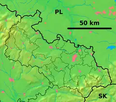 Location of the mouth of the river  Čeladenka (Czech Republic) | |
| Location | |
| Country | Czech Republic |
| Region | Moravian-Silesian |
| Physical characteristics | |
| Source | |
| • location | Moravian-Silesian Beskids |
| • coordinates | 49°27′13.5″N 18°22′16.5″E / 49.453750°N 18.371250°E |
| • elevation | 850 m (2,790 ft) |
| Mouth | Ostravice |
• location | Frýdlant nad Ostravicí |
• coordinates | 49°34′7.3″N 18°21′52.2″E / 49.568694°N 18.364500°E |
• elevation | 375 m (1,230 ft) |
| Length | 17 km (11 mi) |
| Basin size | 43 km2 (17 sq mi) |
| Discharge | |
| • location | mouth |
| • average | 1.08 m3/s (38 cu ft/s) |
| Basin features | |
| Progression | Ostravice→ Oder→ Baltic Sea |
Čeladenka is a small river in the Moravian-Silesian Region of the Czech Republic, with the source in the Moravian-Silesian Beskids, flowing through the village of Čeladná and entering the Ostravice at Frýdlant nad Ostravicí.
Sources
- Moravskoslezské Beskydy. Tourist map 1:50 000. Shocart: Zlín 2002 ISBN 8072241818
- Najbrt Přemysl: Beskydy a Valašsko. Průvodce. Olympia: Praha 1974
- Beskydy. Turistický průvodce ČSSR, vol. 8. Olympia: Praha 1982
External links
- Povodí Odry: levels and flows on watercourses - Čeladenka
- ČHMÚ: Evidenční list hlásného profilu č.280 - Čeladenka
This article is issued from Wikipedia. The text is licensed under Creative Commons - Attribution - Sharealike. Additional terms may apply for the media files.