Six business routes of Arkansas Highway 1 currently exist, with one spur route.[1] Each of the routes is a former alignment of Arkansas Highway 1, which is common practice.
DeWitt business route
Highway 1B | |
|---|---|
| Location | DeWitt |
| Length | 2.13 mi[1] (3.43 km) |
Arkansas Highway 1 Business is a business route in DeWitt. It is 2.13 miles (3.43 km) in length.[1]
- Major intersections
The entire route is in DeWitt, Arkansas County.
| mi[2] | km | Destinations | Notes | ||
|---|---|---|---|---|---|
| 0.0 | 0.0 | Southern terminus | |||
| 0.5 | 0.80 | AR 130 southern terminus | |||
| 1.4 | 2.3 | AR 152 eastern terminus | |||
| 2.2 | 3.5 | Northern terminus | |||
| 1.000 mi = 1.609 km; 1.000 km = 0.621 mi | |||||
St. Charles spur
Highway 1S | |
|---|---|
| Location | St. Charles |
| Length | 0.49 mi[1] (790 m) |
Arkansas Highway 1 Spur is a spur route in St. Charles. Known locally as River View Drive, the route is 0.49 miles (0.79 km) in length.[1] The highway ends at the location of the Battle of Saint Charles on the White River.[3]
- Major intersections
The entire route is in St. Charles, Arkansas County.
| mi[3] | km | Destinations | Notes | ||
|---|---|---|---|---|---|
| 0.0 | 0.0 | Western terminus | |||
| 0.5 | 0.80 | White River | Eastern terminus | ||
| 1.000 mi = 1.609 km; 1.000 km = 0.621 mi | |||||
Marianna business route
Highway 1B | |
|---|---|
| Location | Marianna |
| Length | 1.55 mi[1] (2.49 km) |
Highway 1 Business is a business route in Marianna. It is 1.55 miles (2.49 km) in length, and two-lane undivided.[1]
- Major intersections
The entire route is in Marianna, Lee County.
| mi[4] | km | Destinations | Notes | ||
|---|---|---|---|---|---|
| 0.0 | 0.0 | Southern terminus | |||
| 0.74 | 1.19 | AR 44 eastern terminus | |||
| 1.55 | 2.49 | Northern terminus | |||
| 1.000 mi = 1.609 km; 1.000 km = 0.621 mi | |||||
Forrest City business route
Highway 1B | |
|---|---|
| Location | Forrest City |
| Length | 7.96 mi[1] (12.81 km) |
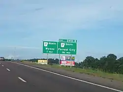
Arkansas Highway 1 Business is a business route in Forrest City. It is 7.96 miles (12.81 km) in length.[1] The highway runs near Forrest City High School.[5]
- Major intersections
The entire route is in Forrest City, St. Francis County.
| mi[5] | km | Destinations | Notes | ||
|---|---|---|---|---|---|
| 0.0 | 0.0 | Southern terminus | |||
| 0.3 | 0.48 | To Forrest City Municipal Airport | |||
| 3.3 | 5.3 | AR 334 northern terminus | |||
| 4.3 | 6.9 | ||||
| 5.1 | 8.2 | AR 284 southern terminus | |||
| 6.2 | 10.0 | I-40 exit 241; cloverleaf interchange. | |||
| 8.1 | 13.0 | Northern terminus | |||
| 1.000 mi = 1.609 km; 1.000 km = 0.621 mi | |||||
Vanndale business route
Highway 1B | |
|---|---|
| Location | Vanndale |
| Length | 1.06 mi[1] (1.71 km) |
Arkansas Highway 1B is a business route (formerly signed as AR 1C, a city route) in Vanndale. It is 1.06 miles (1.71 km) in length.[1]
- Major intersections
The entire route is in Vanndale, Cross County.
| mi[6] | km | Destinations | Notes | ||
|---|---|---|---|---|---|
| 0.00 | 0.00 | Western terminus; western end of AR 364 concurrency | |||
| 0.86 | 1.38 | Eastern end of AR 364 concurrency | |||
| 1.06 | 1.71 | Eastern terminus | |||
1.000 mi = 1.609 km; 1.000 km = 0.621 mi
| |||||
Cherry Valley business route
Highway 1B | |
|---|---|
| Location | Cherry Valley |
| Length | 1.10 mi[1] (1.77 km) |
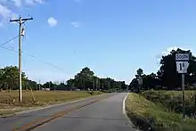
Arkansas Highway 1 Business is a business route in Cherry Valley. It is 1.10 miles (1.77 km) in length.[1]
- Major intersections
The entire route is in Cherry Valley, Cross County.
| mi[6] | km | Destinations | Notes | ||
|---|---|---|---|---|---|
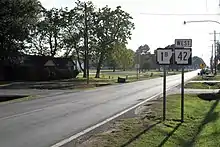
| 0.00 | 0.00 | Southern terminus; southern end of AR 42 concurrency | |||
| 0.30 | 0.48 | Northern end of AR 42 concurrency | |||
| 1.10 | 1.77 | Northern terminus | |||
1.000 mi = 1.609 km; 1.000 km = 0.621 mi
| |||||
Jonesboro business route
Highway 1B | |
|---|---|
| Location | Jonesboro |
| Length | 4.03 mi[1] (6.49 km) |
Arkansas Highway 1 Business is a business route serving downtown Jonesboro.[7] It is 4.03 miles (6.49 km) in length and known as Harrisburg Road.[1]
- Major intersections
The entire route is in Jonesboro, Craighead County.
| mi[7] | km | Destinations | Notes | ||
|---|---|---|---|---|---|
| 0.0 | 0.0 | Southern terminus, begin CRP overlap | |||
| 2.73 | 4.39 | ||||
| 4.03 | 6.49 | Northern terminus, end CRP overlap | |||
| 1.000 mi = 1.609 km; 1.000 km = 0.621 mi | |||||
References
- 1 2 3 4 5 6 7 8 9 10 11 12 13 14 15 "[Arkansas] State Highways 2009 (Database)." April 2010. AHTD: Planning and Research Division. Database. Archived July 7, 2011, at the Wayback Machine Retrieved January 23, 2011.
- ↑ Map of DeWitt, Arkansas (PDF) (Map) (May 2003 ed.). Arkansas State Highway and Transportation Department. Archived from the original (PDF) on March 13, 2012. Retrieved January 16, 2011.
- 1 2 Map of St. Charles, Arkansas (PDF) (Map) (April 2003 ed.). Arkansas State Highway and Transportation Department. Retrieved January 23, 2011.
- ↑ Map of Marianna, Arkansas (PDF) (Map) (April 2003 ed.). Arkansas State Highway and Transportation Department. Retrieved January 23, 2011.
- 1 2 Map of Forrest City, Arkansas (PDF) (Map) (October 2010 ed.). Arkansas State Highway and Transportation Department. Retrieved January 23, 2011.
- 1 2 General Highway Map - Cross County, Arkansas (PDF) (Map) (7/11/07 ed.). Arkansas State Highway and Transportation Department. Archived from the original (PDF) on September 22, 2010. Retrieved January 17, 2011.
- 1 2 General Highway Map - Craighead County, Arkansas (PDF) (Map) (11/12/09 ed.). Arkansas State Highway and Transportation Department. Archived from the original (PDF) on September 2, 2011. Retrieved January 18, 2011.