Béhen | |
|---|---|
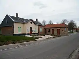 The town hall in Béhen | |
 Coat of arms | |
Location of Béhen | |
 Béhen  Béhen | |
| Coordinates: 50°03′22″N 1°45′21″E / 50.0561°N 1.7558°E | |
| Country | France |
| Region | Hauts-de-France |
| Department | Somme |
| Arrondissement | Abbeville |
| Canton | Abbeville-2 |
| Intercommunality | CC Vimeu |
| Government | |
| • Mayor (2020–2026) | Jean-Claude Parmentier[1] |
| Area 1 | 9.83 km2 (3.80 sq mi) |
| Population | 516 |
| • Density | 52/km2 (140/sq mi) |
| Time zone | UTC+01:00 (CET) |
| • Summer (DST) | UTC+02:00 (CEST) |
| INSEE/Postal code | 80076 /80870 |
| Elevation | 64–114 m (210–374 ft) (avg. 106 m or 348 ft) |
| 1 French Land Register data, which excludes lakes, ponds, glaciers > 1 km2 (0.386 sq mi or 247 acres) and river estuaries. | |
Béhen is a commune in the Somme department in Hauts-de-France in northern France.
Geography
Béhen is situated on the D173 road, 7 miles (11 km) southwest of Abbeville.
Population
| Year | Pop. | ±% p.a. |
|---|---|---|
| 1968 | 436 | — |
| 1975 | 416 | −0.67% |
| 1982 | 446 | +1.00% |
| 1990 | 413 | −0.96% |
| 1999 | 439 | +0.68% |
| 2007 | 435 | −0.11% |
| 2012 | 476 | +1.82% |
| 2017 | 509 | +1.35% |
| Source: INSEE[3] | ||
See also
References
- ↑ "Répertoire national des élus: les maires". data.gouv.fr, Plateforme ouverte des données publiques françaises (in French). 2 December 2020.
- ↑ "Populations légales 2021". The National Institute of Statistics and Economic Studies. 28 December 2023.
- ↑ Population en historique depuis 1968, INSEE
Wikimedia Commons has media related to Béhen.
This article is issued from Wikipedia. The text is licensed under Creative Commons - Attribution - Sharealike. Additional terms may apply for the media files.