| Bidein a' Chabair | |
|---|---|
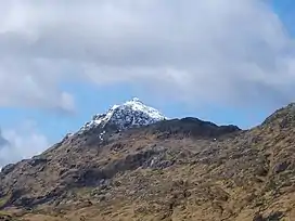 Bidein a' Chabair in snow. | |
| Highest point | |
| Elevation | 867 m (2,844 ft)[1] |
| Prominence | 552 m (1,811 ft) |
| Listing | Corbett, Marilyn |
| Coordinates | 56°58′48″N 5°28′39″W / 56.9800°N 5.4775°W |
| Geography | |
| Location | Lochaber, Scotland |
| Parent range | Northwest Highlands |
| OS grid | NM889930 |
| Topo map | OS Landranger 33, 40 |
Bidein a' Chabair (867 m) is a mountain in the Knoydart peninsula, Lochaber, on the west coast of Scotland. It is part of the Northwest Highlands.
A conical peak, it lies in one of the most remote and rugged corners of Scotland. The nearest town is Fort William.[2]
References
- ↑ "Bidein a' Chabair". hill-bagging.co.uk. Retrieved 6 May 2019.
- ↑ "walkhighlands Bidein a' Chabair". walkhighlands.co.uk. Retrieved 6 May 2019.
This article is issued from Wikipedia. The text is licensed under Creative Commons - Attribution - Sharealike. Additional terms may apply for the media files.