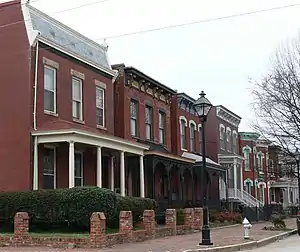
A row of houses in the Jackson Ward neighborhood of Richmond. The district was listed as a Landmark District in 1978.
Richmond, Virginia, is the capital city of the Commonwealth of Virginia, and the fifth largest city in the state in terms of population,[1] and the main anchor city for the Greater Richmond Region, the third largest metropolitan statistical area in the Commonwealth, and the 43rd largest in the United States.[2] The City of Richmond is divided into five distinct districts, each district is further subdivided into several neighborhoods, although there is no formal criterion as to what defines a neighborhood within the City of Richmond. The five districts of Richmond are Downtown, East End, North Side, Southside, and West End.
Below is a list of neighborhoods in Richmond, Virginia, divided by their district:
Downtown
East End
- Brauers
- Chimborazo
- Church Hill
- Creighton
- Eastview
- Fairfield
- Fairmount
- Fulton Hill
- Montrose Heights
- Mosby
- Navy Hill
- Oakwood
- Peter Paul
- Tobacco Row
- Union Hill
- Witcomb Court
Northside
- Barton Heights
- Bellevue
- Chamberlayne Industrial Center
- Edgewood
- Gilpin
- Ginter Park
- Green Park
- Hermitage Road
- Highland Park
- Highland Terrace
- Laburnum Park
- Magnolia Industrial Center
- North Highland Park
- Pine Camp
- Providence Park
- Rosedale
- Sherwood Park
- South Barton Heights
- Three Corners
- Washington Park
Southside
- Ancarrow's Landing
- Bellemeade
- Belmont Woods
- Blackwell
- Brandermill
- Broad Rock
- Brookbury
- Cherry Gardens
- Chippenham Forest
- Cofer
- Cottrell Farms
- Forest Hill
- Gravel Hill
- Hickory Hill
- Hillside Court
- Huguenot
- Jahnke
- Manchester
- Maury
- McGuire
- North Chesterfield
- Northrop
- Oak Grove
- Oxford
- Piney Knolls
- South Richmond
- Southampton
- Stoney Point
- Stratford Hills
- Swansboro
- Walmsley
- Warwick
- Windsor
- Woodhaven
- Woodland Heights
- Worthington
West End
- Byrd Park
- Carillon
- Carver
- Carytown
- Colonial Place
- Byrd Park
- The Fan
- Malvern Gardens
- Maymount
- Museum District
- Newtowne West
- Oregon Hill
- Randolph
- Rhoadmiller
- Scott's Addition
- Stadium
- Stonewall Court
- West of the Boulevard
- Westhampton
- Willow Lawn
- Wilton
- Windsor Farms
References
- ↑ Brinkhoff, Thomas. "Virginia (USA): State, Major Cities, Places & Towns". US Census Bureau. CityPopulation.de. Retrieved February 2, 2013.
- ↑ "2010 Census Data for Virginia" (PDF). U.S. Census. Census.gov. Retrieved February 2, 2013.
External links
Richmond, Virginia Metropolitan Statistical Area | |
|---|---|
| See also | |
| |
This article is issued from Wikipedia. The text is licensed under Creative Commons - Attribution - Sharealike. Additional terms may apply for the media files.