| Cimetta | |
|---|---|
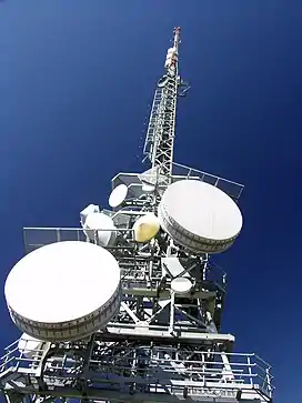 Radio relay tower on the top | |
| Highest point | |
| Elevation | 1,671 m (5,482 ft) |
| Prominence | 61 m (200 ft)[1] |
| Coordinates | 46°12′03″N 8°47′27.8″E / 46.20083°N 8.791056°E |
| Geography | |
 Cimetta | |
| Parent range | Lepontine Alps |
| Climbing | |
| Easiest route | Aerial tramway |
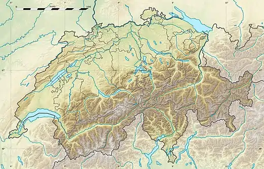
Cimetta is a mountain in the Lepontine Alps, it is located above Locarno and Lake Maggiore.
The Locarno–Madonna del Sasso funicular links Locarno city centre with Orselina. From there a cable car connects to Cardada, from which a chair lift runs to the summit.
Climate
| Climate data for Cimetta: 1661m (1991–2020) | |||||||||||||
|---|---|---|---|---|---|---|---|---|---|---|---|---|---|
| Month | Jan | Feb | Mar | Apr | May | Jun | Jul | Aug | Sep | Oct | Nov | Dec | Year |
| Mean daily maximum °C (°F) | 1.5 (34.7) |
1.5 (34.7) |
4.2 (39.6) |
7.5 (45.5) |
12.3 (54.1) |
16.0 (60.8) |
18.3 (64.9) |
18.1 (64.6) |
13.9 (57.0) |
9.8 (49.6) |
4.9 (40.8) |
2.2 (36.0) |
9.2 (48.6) |
| Daily mean °C (°F) | −1.1 (30.0) |
−1.3 (29.7) |
0.9 (33.6) |
3.7 (38.7) |
7.9 (46.2) |
11.8 (53.2) |
14.0 (57.2) |
13.9 (57.0) |
9.9 (49.8) |
6.3 (43.3) |
2.1 (35.8) |
−0.4 (31.3) |
5.6 (42.1) |
| Mean daily minimum °C (°F) | −3.6 (25.5) |
−3.7 (25.3) |
−1.5 (29.3) |
1.1 (34.0) |
5.2 (41.4) |
9.1 (48.4) |
11.2 (52.2) |
11.3 (52.3) |
7.6 (45.7) |
4.1 (39.4) |
0.0 (32.0) |
−2.7 (27.1) |
3.2 (37.8) |
| Average precipitation mm (inches) | 49 (1.9) |
50 (2.0) |
73 (2.9) |
132 (5.2) |
179 (7.0) |
178 (7.0) |
147 (5.8) |
194 (7.6) |
189 (7.4) |
196 (7.7) |
159 (6.3) |
64 (2.5) |
1,609 (63.3) |
| Average precipitation days (≥ 1.0 mm) | 5.6 | 5.2 | 6.6 | 10.2 | 12.4 | 10.6 | 9.8 | 10.9 | 9.3 | 10.1 | 10.2 | 7.0 | 107.9 |
| Average relative humidity (%) | 58 | 59 | 63 | 69 | 72 | 73 | 72 | 74 | 77 | 74 | 67 | 59 | 68 |
| Mean monthly sunshine hours | 160 | 168 | 206 | 188 | 201 | 228 | 258 | 236 | 182 | 156 | 131 | 142 | 2,256 |
| Percent possible sunshine | 61 | 61 | 58 | 48 | 46 | 52 | 58 | 57 | 51 | 49 | 50 | 57 | 54 |
| Source: MeteoSwiss[2] | |||||||||||||
See also
References
- ↑ Swisstopo maps
- ↑ "Climate Normals Cimetta (Reference period 1991−2020)" (PDF). Swiss Federal Office of Meteorology and Climatology, MeteoSwiss. 13 January 2022. Retrieved 13 January 2022.
External links
This article is issued from Wikipedia. The text is licensed under Creative Commons - Attribution - Sharealike. Additional terms may apply for the media files.