Vercurago
Vercürach | |
|---|---|
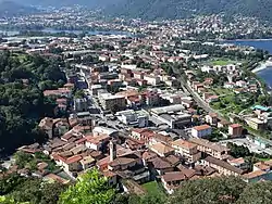 Views on Vercurago | |
 Seal | |
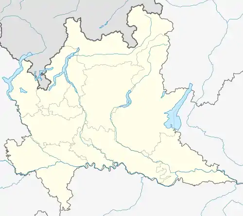 Vercurago Location within Lombardy  Vercurago Location within Italy | |
| Coordinates: 45°49′0″N 9°25′0″E / 45.81667°N 9.41667°E | |
| Sovereign State | Italy |
| Region | Lombardy |
| Province | Province of Lecco |
| Settled by Longobards | 814[1] as Vercoriaco |
| Frazioni | Somasca |
| Government | |
| • Type | Mayor-council government |
| • Mayor | Carlo Greppi (Ind.) |
| Area | |
| • Total | 2.12 km2 (0.82 sq mi) |
| Elevation | 225 m (738 ft) |
| Population (31 May 2018)[2] | |
| • Total | 2,817 |
| • Density | 1,325/km2 (3,430/sq mi) |
| Demonym | Vercuraghesi |
| Time zone | UTC+1 (CET) |
| • Summer (DST) | UTC+2 (CEST) |
| Postcode (CAP) | 23808 |
| Area code | 0341 |
| Vehicle registration | LC |
| Land registry code | L751 |
| Patron saint | San Gerolamo Emiliani, Saints Gervasius and Protasius |
| Festivity day | 8 February |
| Website | |
Vercurago (Bergamasque: Vercürach) is a comune (municipality) in the Province of Lecco in the Italian region Lombardy, located about 45 kilometres (28 mi) northeast of Milan and about 4 kilometres (2 mi) southeast of Lecco.
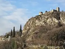
Innominato's castle
Vercurago borders the following municipalities: Calolziocorte, Erve, Garlate, Lecco, Olginate.
References
- ↑ "Vercurago history". Comune di Vercurago. Retrieved 29 October 2018.
- ↑ "Vercurago Populations". Istat. Retrieved 29 October 2018.
External links
This article is issued from Wikipedia. The text is licensed under Creative Commons - Attribution - Sharealike. Additional terms may apply for the media files.