Cuijk | |
|---|---|
Former municipality | |
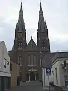
.jpg.webp) Monumental church in Cuijk | |
 Flag Coat of arms | |
.svg.png.webp) Location of the former municipality of Cuijk in North Brabant | |
| Coordinates: 51°44′N 5°53′E / 51.733°N 5.883°E | |
| Country | Netherlands |
| Province | North Brabant |
| Municipality | Land van Cuijk |
| Area | |
| • Total | 57.07 km2 (22.03 sq mi) |
| • Land | 51.16 km2 (19.75 sq mi) |
| • Water | 5.91 km2 (2.28 sq mi) |
| Elevation | 12 m (39 ft) |
| Population (January 2021)[3] | |
| • Total | 25,404 |
| • Density | 497/km2 (1,290/sq mi) |
| Demonym | Cuijkenaar |
| Time zone | UTC+1 (CET) |
| • Summer (DST) | UTC+2 (CEST) |
| Postcode | 5430–5437, 5439 |
| Area code | 0485 |
| Website | www |
Cuijk (Dutch pronunciation: [kœyk] ⓘ) is a former municipality in upper southeastern Netherlands. Cuijk, Boxmeer, Grave, Mill en Sint Hubert, and Sint Anthonis merged into the new municipality of Land van Cuijk on 1 January 2022.
The former municipality of Cuijk was established by combining the municipalities of Cuijk en Sint Agatha, Beers and Haps in 1994.
Population centres
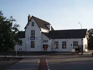
The main population center Cuijk is of pre-historic origin. Its existence is recorded on the Roman roadmap Tabula Peutingeriana under the name of Ceuclum. It is a big commuter town with good public transport services to nearby Nijmegen. The nearest hospital is at Boxmeer and the nearest international airport is situated in the German town of Weeze. Cuijk has a railway station on the Nijmegen to Venlo railway.
Population centers and inhabitants in 2020:[4]
Topography
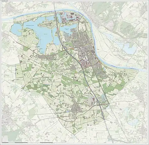
Map of the former municipality of Cuijk, 2015
Transportation
Twin towns
Cuijk was twinned with
|
Notable people
- Jan de Quay (1901 – 1985 in Beers) a Dutch politician and psychologist, Prime Minister of the Netherlands 1959/1963
- Pieter Bogaers (1924 in Cuijk – 2008) a Dutch politician
- Jordie van der Laan (born 1993 in Cuijk) a Dutch football player
Gallery
 Cuijk, church: Sint-Martinuskerk
.jpg.webp) Sint-Martinuskerk viewed from the Maas river
Sint-Martinuskerk viewed from the Maas river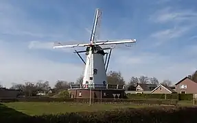 Cuijk, windmill: windmolen Jan van Cuijk
_former_town_hall_(_ca._1880_-_1942).JPG.webp) Former town hall, between Katwijk and Linden
Former town hall, between Katwijk and Linden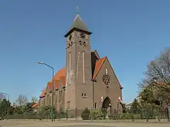 Vianen, church
 Kraaijenbergse Plassen, double-beam drawbridge
References
- ↑ "Kerncijfers wijken en buurten 2020" [Key figures for neighbourhoods 2020]. StatLine (in Dutch). CBS. 24 July 2020. Retrieved 19 September 2020.
- ↑ "Postcodetool for 5431BV". Actueel Hoogtebestand Nederland (in Dutch). Het Waterschapshuis. Retrieved 8 May 2014.
- ↑ "Bevolkingsontwikkeling; regio per maand" [Population growth; regions per month]. CBS Statline (in Dutch). CBS. 1 January 2021. Retrieved 2 January 2022.
- ↑ "CBS in uw buurt" (in Dutch). CBS. Retrieved 23 September 2021.
External links
 Media related to Cuijk at Wikimedia Commons
- Official website
Places adjacent to Cuijk (municipality) | ||||||||||||||||
|---|---|---|---|---|---|---|---|---|---|---|---|---|---|---|---|---|
| ||||||||||||||||