Dingbian County
定边县 Tingpien | |
|---|---|
.jpg.webp) View of the seat of Dingbian from the Dingbian branch line of the Taiyuan–Zhongwei–Yinchuan railway | |
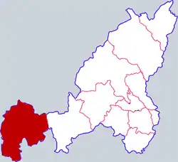 Dingbian in Yulin | |
.png.webp) Yulin in Shaanxi | |
| Country | People's Republic of China |
| Province | Shaanxi |
| Prefecture-level city | Yulin |
| Established | 1731 |
| Area | |
| • Total | 6,920 km2 (2,670 sq mi) |
| Population () | |
| • Total | 344,900 |
| • Density | 50/km2 (130/sq mi) |
| Time zone | UTC+8 (China standard time) |
| Postal Code | 718699 |
| Area code | (0)912 |
| Licence plates | 陕K |
| Website | dingbian |
Dingbian County (simplified Chinese: 定边县; traditional Chinese: 定邊縣; pinyin: Dìngbiān Xiàn) is a county in the northwest of Shaanxi province, China, bordering the Ningxia Hui Autonomous Region to the west and Inner Mongolia to the north. It is the westernmost county-level division under the administration of Yulin City.
Administrative divisions
As of 2020, Dingbian County is divided to 1 subdistrict, 16 towns, and 2 townships.[1]
- Subdistricts
- Dingbian Subdistrict (定边街道)
- Towns
|
|
- Townships
- Youfangzhuang Township (油房庄乡)
- Xuezhuang Township (学庄乡)
Climate
| Climate data for Dingbian (1991–2020 normals, extremes 1981–2010) | |||||||||||||
|---|---|---|---|---|---|---|---|---|---|---|---|---|---|
| Month | Jan | Feb | Mar | Apr | May | Jun | Jul | Aug | Sep | Oct | Nov | Dec | Year |
| Record high °C (°F) | 15.6 (60.1) |
19.1 (66.4) |
27.4 (81.3) |
33.3 (91.9) |
35.5 (95.9) |
36.6 (97.9) |
37.7 (99.9) |
36.2 (97.2) |
34.9 (94.8) |
27.7 (81.9) |
23.1 (73.6) |
17.2 (63.0) |
37.7 (99.9) |
| Mean daily maximum °C (°F) | 0.4 (32.7) |
4.8 (40.6) |
11.4 (52.5) |
18.7 (65.7) |
23.9 (75.0) |
28.3 (82.9) |
29.7 (85.5) |
27.5 (81.5) |
22.4 (72.3) |
16.4 (61.5) |
9.1 (48.4) |
2.1 (35.8) |
16.2 (61.2) |
| Daily mean °C (°F) | −6.9 (19.6) |
−2.6 (27.3) |
4.2 (39.6) |
11.4 (52.5) |
17.1 (62.8) |
21.6 (70.9) |
23.3 (73.9) |
21.2 (70.2) |
16.1 (61.0) |
9.4 (48.9) |
2.0 (35.6) |
−4.9 (23.2) |
9.3 (48.8) |
| Mean daily minimum °C (°F) | −13.1 (8.4) |
−9.0 (15.8) |
−2.2 (28.0) |
4.4 (39.9) |
10.0 (50.0) |
14.7 (58.5) |
17.3 (63.1) |
15.6 (60.1) |
10.5 (50.9) |
3.5 (38.3) |
−3.8 (25.2) |
−10.8 (12.6) |
3.1 (37.6) |
| Record low °C (°F) | −27.7 (−17.9) |
−26.8 (−16.2) |
−21.7 (−7.1) |
−9.7 (14.5) |
−3.9 (25.0) |
3.6 (38.5) |
7.4 (45.3) |
5.7 (42.3) |
−2.7 (27.1) |
−11.5 (11.3) |
−20.8 (−5.4) |
−29.1 (−20.4) |
−29.1 (−20.4) |
| Average precipitation mm (inches) | 2.8 (0.11) |
3.4 (0.13) |
6.9 (0.27) |
17.8 (0.70) |
32.5 (1.28) |
45.5 (1.79) |
71.3 (2.81) |
79.7 (3.14) |
53.3 (2.10) |
21.6 (0.85) |
10.1 (0.40) |
2.0 (0.08) |
346.9 (13.66) |
| Average precipitation days (≥ 0.1 mm) | 2.8 | 2.1 | 3.1 | 4.6 | 5.8 | 7.3 | 9.6 | 10.0 | 8.9 | 5.7 | 3.5 | 1.6 | 65 |
| Average snowy days | 4.2 | 3.6 | 3.0 | 1.0 | 0 | 0 | 0 | 0 | 0 | 0.9 | 2.9 | 3.0 | 18.6 |
| Average relative humidity (%) | 50 | 46 | 41 | 38 | 40 | 46 | 57 | 64 | 65 | 57 | 52 | 49 | 50 |
| Mean monthly sunshine hours | 207.3 | 199.4 | 227.2 | 238.7 | 266.3 | 262.6 | 249.2 | 232.7 | 201.8 | 221.3 | 209.3 | 202.5 | 2,718.3 |
| Percent possible sunshine | 67 | 65 | 61 | 60 | 60 | 60 | 56 | 56 | 55 | 65 | 70 | 68 | 62 |
| Source: China Meteorological Administration[2][3] | |||||||||||||
Transportation
- China National Highway 307
- G20 Qingdao–Yinchuan Expressway
- Taiyuan-Zhongwei-Yinchuan Railway; at Dingbian, the Dingbian-Yinchuan branch joins the main Taiyuan-Zhongwei line.
References
- ↑ 2020年统计用区划代码(定边县) [2020 Statistical Division Codes (Dingbian County)] (in Chinese). National Bureau of Statistics of China. 2020. Archived from the original on 2021-06-05. Retrieved 2021-06-05.
- ↑ 中国气象数据网 – WeatherBk Data (in Simplified Chinese). China Meteorological Administration. Retrieved 26 August 2023.
- ↑ 中国气象数据网 (in Simplified Chinese). China Meteorological Administration. Retrieved 26 August 2023.
37°26′59″N 107°49′44″E / 37.44972°N 107.82889°E
This article is issued from Wikipedia. The text is licensed under Creative Commons - Attribution - Sharealike. Additional terms may apply for the media files.