Fuencarral-El Pardo | |
|---|---|
_04.jpg.webp) M-30 ring highway over the district | |
 | |
| Country | |
| Aut. community | |
| Municipality | |
| Area | |
| • Total | 237.81 km2 (91.82 sq mi) |
| Population | 220,085 |
| • Density | 925.5/km2 (2,397/sq mi) |
| Madrid district number | 8 |
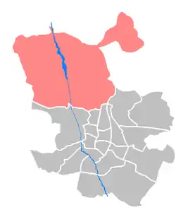
Fuencarral-El Pardo is one of the 21 districts that form the city of Madrid, Spain.
Overview
Fuencarral-El Pardo is the district number 8 and consists of the following neighborhoods: El Pardo (81), Fuentelarreina (82), Peñagrande (83), Pilar (84), La Paz (85), Valverde (86), Mirasierra (87) and El Goloso (88).
Despite its being a part of a capital city, El Pardo with its woods and river is an ecologically important landscape. It enjoyed protection from development as a hunting estate associated with the Royal Palace of El Pardo. In the 1980s the European Union designated the Monte de El Pardo as a Special Protection Area for bird-life.[1]
Geography
Subdivision
The district is administratively divided into 8 wards (Barrios):
Education
_01.jpg.webp)
The new campus of the Deutsche Schule Madrid, in Montecarmelo (ES) in the district, opened in the fall of 2015.[2]
See also
References
- ↑ "El Monte de El Pardo".
- ↑ "El nuevo Colegio Alemán de Madrid, la mayor obra civil alemana del extranjero" (Archive). La Vanguardia. 9 October 2015. Retrieved on 2 April 2016.
External links
![]() Media related to Fuencarral-El Pardo at Wikimedia Commons
Media related to Fuencarral-El Pardo at Wikimedia Commons
40°28′43″N 3°42′35″W / 40.47861°N 3.70972°W