| Scaw'd Law | |
|---|---|
 | |
| Highest point | |
| Elevation | 663 m (2,175 ft)[1] |
| Prominence | 58 m (190 ft)[1] |
| Listing | Tu,Sim,D,GT,DN[2] |
| Geography | |
| Location | Southern Uplands, Scotland |
| Parent range | Lowther Hills, Southern Uplands |
| OS grid | NS 92219 03784 |
| Topo map | OS Landranger 78 |
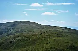
Scaw'd Law is a hill in the Lowther Hills range, part of the Southern Uplands of Scotland. The Dumfries and Galloway-South Lanarkshire border runs along its summit, which is notable for having two similar rounded tops; the top 300m to the north is likely the true summit.[1] Surrounded on most sides by tracks or roads, there are various routes to the summit, but the most frequent ascents are from Durisdeer or the Daer Reservoir.[1]
Subsidiary SMC Summits
| Summit | Height (m) | Listing[2] |
|---|---|---|
| Glenleith Fell | 612 | DT,sSim[3] |
References
- 1 2 3 4 "Scaw'd Law". www.hill-bagging.co.uk.
- 1 2 "Database of British and Irish Hills: user guide". www.hills-database.co.uk.
- ↑ "Glenleith Fell". www.hill-bagging.co.uk.
This article is issued from Wikipedia. The text is licensed under Creative Commons - Attribution - Sharealike. Additional terms may apply for the media files.