Haitang
海棠区 | |
|---|---|
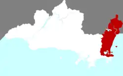 Location of Haitang in Sanya | |
.png.webp) Sanya in Hainan | |
| Coordinates: 18°24′27″N 109°45′39″E / 18.4075°N 109.7608°E | |
| Country | People's Republic of China |
| Province | Hainan |
| Prefecture-level city | Sanya |
| Area | |
| • Total | 252.41 km2 (97.46 sq mi) |
| Population (2013) | |
| • Total | 90,000 |
| • Density | 360/km2 (920/sq mi) |
| Time zone | UTC+8 (China standard time) |
Haitang District (Chinese: 海棠区; pinyin: Hǎitáng Qū) is a county-level district under the jurisdiction of the city of Sanya, Hainan province, China. The district was established on 12 February 2014.[1]
Former administrative subdivisions
Haitang has jurisdiction over the former towns of:
| English Name | Simplified | Pinyin | Area | Population | Density |
|---|---|---|---|---|---|
| Haitangwan | 海棠湾镇 | Hǎitángwān Zhèn | 254 | 44,617 | 176 |
| Nantian Farm | 国营南田农场 | Guóyíng Nántián Nóngchǎng | N.D. | 24,280 | N.D. |
References
- ↑ 国务院批准三亚撤六乡镇设四区. SINA. Retrieved 28 March 2014.
County-level divisions of Hainan | ||||||||||||||||||
|---|---|---|---|---|---|---|---|---|---|---|---|---|---|---|---|---|---|---|
| Prefecture-level cities |
|  Hainan in China | ||||||||||||||||
| Provincial administered |
| |||||||||||||||||
Hainan topics | |
|---|---|
| General | |
| Geography | |
| Flora and fauna | |
| Media | |
| Transportation | |
| Education | |
| Demographics | |
| Buildings and structures | |
| Cuisine | |
| Visitor attractions | |
| |
This article is issued from Wikipedia. The text is licensed under Creative Commons - Attribution - Sharealike. Additional terms may apply for the media files.