| Ifinger | |
|---|---|
 | |
| Highest point | |
| Elevation | 2,581 m (8,468 ft) |
| Prominence | 258 m (846 ft) |
| Isolation | 1.67 km (1.04 mi) |
| Coordinates | 46°41′35.71″N 11°15′19.77″E / 46.6932528°N 11.2554917°E |
| Geography | |
| Location | South Tyrol, Italy |
| Parent range | Sarntal Alps |
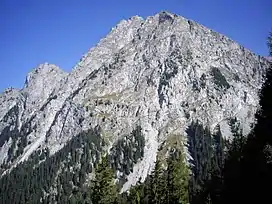
The Ifinger is a mountain in the Sarntal Alps in South Tyrol, Italy.
References
- Alpenverein South Tyrol (in German)
External links
![]() Media related to Ifinger at Wikimedia Commons
Media related to Ifinger at Wikimedia Commons
This article is issued from Wikipedia. The text is licensed under Creative Commons - Attribution - Sharealike. Additional terms may apply for the media files.