Native name: Isla Popa | |
|---|---|
 Bocas del Toro Archipelago | |
| Geography | |
| Coordinates | 9°9′N 82°7′W / 9.150°N 82.117°W |
| Archipelago | Bocas del Toro Archipelago |
| Area | 53 km2 (20 sq mi) |
| Highest elevation | 0 m (0 ft) |
| Administration | |
| Province | Bocas del Toro |
| District | Bocas del Toro |
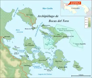
Popa Island (in Spanish: Isla Popa) is the second largest island in the Bocas del Toro Archipelago, Panama, with 53 square kilometres (20 square miles).[1]
See also
References
- ↑ St. Louis, Regis & Scott Doggett (2004), Lonely Planet Panama, Lonely Planet Publications, p. 227, ISBN 1-74104-133-3
| Islands | 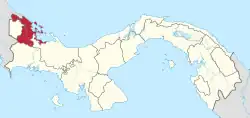 | |
|---|---|---|
| Protected areas | ||
| Settlements |
| |
This article is issued from Wikipedia. The text is licensed under Creative Commons - Attribution - Sharealike. Additional terms may apply for the media files.