6  | |
|---|---|
| 국도 제6호선 | |
| Route information | |
| Length | 274.3 km (170.4 mi) |
| Existed | 31 August 1971–present |
| Major junctions | |
| West end | Jung-gu, Incheon |
| East end | Gangneung, Gangwon Province |
| Location | |
| Country | South Korea |
| Highway system | |
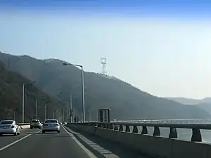
Route 6 at Yangseo, Yangpyeong, Gyeonggi Province
National Route 6 (Korean: 국도 제6호선; Gukdo Je Yuk(6) Hoseon)is a major highway on the Korea It connects Incheon with the city of Gangneung, Gangwon Province,
Main stopovers[1]
Major intersections
- (■): Motorway
IS: Intersection, IC: Interchange
Incheon
| Name[2] | Hangul name | Connection | Location | Note | |
|---|---|---|---|---|---|
| Incheon station | 인천역 | National Route 42 National Route 46 National Route 77 Prefectural Route 84 Prefectural Route 98 (Jemullyang-ro) Wolmi-ro China town-ro 51beon-gil |
Incheon | Jung District | Terminus National Route 77 overlap Prefectural Route 84, 98 overlap |
| Songwol Market | 송월시장 | Chamoejeon-ro | National Route 77 overlap Prefectural Route 84, 98 overlap | ||
| Manseok Overpass | 만석고가교 | ||||
| Dong District | |||||
| Dong-il Corp. Incheon Factory Incheon Manseok Elementary School |
동일방직 인천공장 인천만석초등학교 |
||||
| Hwasu IS | 화수사거리 | Injung-ro Jemullyang-ro | |||
| Songhyeon IS | 송현사거리 | Prefectural Route 84 (Jungbong-daero) Songhyeon-ro | |||
| Hwanggeumgogae IS | 황금고개사거리 | Saetgol-ro Injung-ro |
National Route 77 overlap Prefectural Route 98 overlap | ||
| Seoheung Elementary School | 서흥초등학교 | ||||
| Songrim IS | 송림오거리 | Dongsan-ro Saetgol-ro Songrim-ro | |||
| No name | (이름 없음) | Saecheonnyeon-ro | |||
| Songrim IS | 송림삼거리 | Bongsu-daero Injung-ro | |||
| Songrimgogae | 송림고개 | ||||
| Nam District | |||||
| Incheondae IS | 인천대삼거리 | Sukgol-ro | |||
| Incheon Seohwa Elementary School | 인천서화초등학교 | ||||
| Gunghyeon IS | 궁현사거리 | Yeomjeon-ro | |||
| Incheongyo IS | 인천교삼거리 | Janggogae-ro | |||
| Donggu Public Stadium | 동구구민운동장 | ||||
| Gajwa IS (Gajwa IC IS) |
가좌 나들목 (가좌IC앞 교차로) |
Gyeongin Expressway Baekbeom-ro Janggogae-ro |
Seo District | ||
| Seoknamje 2 Overpass | 석남제2고가교 | National Route 77 overlap Prefectural Route 98 overlap Pass through | |||
| Seoknamje 1 Overpass | 석남제1고가교 | Gilju-ro | |||
| Yuldo Entrance IS | 율도입구삼거리 | Yuldo-ro | National Route 77 overlap Prefectural Route 98 overlap | ||
| Ruwon IS | 루원 교차로 | Prefectural Route 98 (Seogot-ro) Bongo-daero | |||
| (North of Hyoseong Overpass) | (효성고가교 북단) | Bongo-daero Cheongan-ro Hyoseo-ro |
Gyeyang District | National Route 77 overlap Continuation into Gyeonggi Province | |
| Saemal IS | 새말사거리 | Majang-ro | |||
| Hyoseong IS | 효성사거리 | Annam-ro | |||
| Nadeulmok IS (Bupyeong IC) |
나들목사거리 (부평 나들목) |
Gyeongin Expressway Gyeyang-daero | |||
| Jakjeon Overpass IS | 작전고가앞 교차로 | Jubuto-ro | |||
| Meddeul IS | 메뜰사거리 | Jangje-ro | |||
| Seowoon Middle School Seowoon High School |
서운중학교 서운고등학교 |
||||
| Cheonsang Bridge | 천상교 | ||||
Gyeonggi Province Bucheon
| Name[3] | Hangul name | Connection | Location | Note | |
|---|---|---|---|---|---|
| Cheonsang Bridge | 천상교 | Bucheon City | Ojeong-dong | National Route 77 overlap Incheon - Bucheon border line | |
| Automobile Inspection Station IS | 자동차검사소삼거리 | Ojeong-ro 39beon-gil | |||
| No name | (이름 없음) | National Route 39 (Seokcheon-ro) |
National Route 39, National Route 77 overlap | ||
| Saneopgil IS (Bucheon IC) |
산업길사거리 (부천 나들목) |
National Route 39 (Sinheung-ro) | |||
| Naechon Overpass Entrance | 내촌고가입구 | Bucheon-ro | National Route 77 overlap Continuation into Seoul | ||
| Upyeon Mail Center IS | 우편집중국삼거리 | Ojeong-ro 211beon-gil | |||
| OBS Gyeongin TV | OBS 경인TV | ||||
| Duksan High School | 덕산고등학교 | Ojeong-ro 251beon-gil Ojeong-ro 252beon-gil | |||
| Bongo-daero IS | 봉오대로사거리 | Bongo-daero | |||
| Daejangdong Entrance IS | 대장동입구 교차로 | Daejang-ro | Gogang-dong | ||
| Asiana Airlines Entrance | 아시아나항공입구 | ||||
| Osoe IS | 오쇠삼거리 | Sosa-ro Sosa-ro 970beon-gil | |||
Seoul
.jpg.webp)
Hongik University Sta. in Mapo District
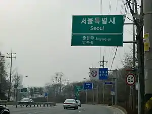
National Route 6 in Jungnang District, Seoul
| Name[4] | Hangul name | Connection | Location | Note | |
|---|---|---|---|---|---|
| Osoe IS | 오쇠삼거리 | Sosa-ro Sosa-ro 970beon-gil |
Seoul | Gangseo District | National Route 77 overlap Gyeonggi Province - Seoul border line |
| Oebalsan IS | 외발산사거리 | Nambu Beltway Banghwa-daero | |||
| Magok station IS | 마곡역 교차로 | National Route 48 (Gonghang-daero) |
National Route 48, National Route 77 overlap | ||
| Balsan station IS | 발산역 교차로 | Gangseo-ro | |||
| Korea Gas Corporation KBS SPORTS WORLD |
한국가스공사 KBS스포츠월드 |
||||
| Gangseo District Office IS | 강서구청사거리 | Hwagok-ro | |||
| Deungchon Middle School Seoul Baekseok Elementary School National Information Society Agency |
등촌중학교 서울백석초등학교 한국정보화진흥원 |
||||
| Deungchon station IS | 등촌역 교차로 | Deungchon-ro Gonghang-daero 59-gil |
Yangcheon District | ||
| Yeomchang station | 염창역 | ||||
| Yanghwa Bridge | 양화교 | Anyangcheon-ro Yangcheon-ro | |||
| Yeongdeungpo District | |||||
| South of Seongsan Bridge IS | 성산대교남단 교차로 | National Route 1 National Route 48 (Seobu Expressway) | |||
| South of Yanghwa Bridge IS | 양화대교남단 교차로 | Nodeul-ro Seonyu-ro |
National Route 77 overlap | ||
| Yanghwa Bridge | 양화대교 | ||||
| Mapo District | |||||
| North of Yanghwa Bridge IS | 양화대교북단 교차로 | National Route 77 Prefectural Route 23 (Gangbyeon Expressway) | |||
| Hapjeong station IS | 합정역교차로 | Dongmak-ro World Cup-ro |
|||
| Hongik University station Donggyo-dong IS |
홍대입구역 동교동삼거리 |
Yeonhui-ro | |||
| Changcheon-dong IS | 창천동삼거리 | Wausan-ro | |||
| Sinchon Rotary Sinchon station |
신촌로터리 지하 신촌역 |
Baekbeom-ro Seogang-ro Yonsei-ro |
|||
| Sinchon station Entrance | 신촌기차역입구 | Sinchonyeok-ro | |||
| Ewha Womans University station IS | 이대역교차로 | Daeheung-ro Ewhayeodae-gil |
|||
| Ahyeon station IS | 아현역교차로 | Gullebang-ro Bugahyeon-ro |
Seodaemun District | ||
| Ahyeon IS | 아현교차로 | Mapo-daero | |||
| Chungjeongno IS (Chungjeongno station) (Ahyeon Overpass) |
충정로사거리 (충정로역) (아현고가차도) |
Seosomun-ro Kyonggidae-ro |
|||
| Seodaemun station IS (Seodaemun Station Overpass) |
서대문역교차로 (서대문역고가차도) |
Tongil-ro | |||
| Jeongdong IS | 정동사거리 | Songwol-gil Jeongdong-gil |
|||
| Gyeonghuigung | 경희궁 | Jongno District | |||
| Sejong-daero IS | 세종대로사거리 | National Route 48 (Sejong-daero) |
|||
| Jongno 1-ga IS (Jonggak station) |
종로1가교차로 (종각역) |
Ujeongguk-ro | |||
| Jongno 2-ga IS | 종로2가교차로 | Samil-daero | |||
| Jongno 3-ga station | 종로3가역 | Donhwamun-ro | |||
| Jongno 4-ga IS | 종로4가교차로 | Changgyeonggung-ro | |||
| Jongno 5-ga IS (Jongno 5-ga station) |
종로5가교차로 (종로5가역) |
Daehak-ro Dongho-ro |
|||
| Heunginjimun IS (Dongdaemun station) |
흥인지문교차로 (동대문역) |
Yulgok-ro | |||
| Dongmyo station | 동묘앞역 | Jibong-ro | |||
| Sinseol-dong station IS | 신설동역교차로 | Nangye-ro Bomun-ro Cheonho-daero |
Dongdaemun District | ||
| Yongdu-dong IS | 용두동사거리 | Muhak-ro | |||
| Jegi-dong station | 제기동역 | ||||
| Kyungdong Market IS | 경동시장사거리 | Gosanja-ro | |||
| Catholic Univ. of Korea St. Paul's Hospital IS | 성바오로병원교차로 | Dapsimni-ro | |||
| Cheongnyangni station IS | 청량리역교차로 | Hongneung-ro | |||
| Ddeokjeon Bridge IS | 떡전교사거리 | Jegi-ro Jeonnong-ro |
|||
| Sijosa IS | 시조사삼거리 | Imun-ro | |||
| Hoegi station | 회기역 | ||||
| Sahmyook Medical Center | 삼육서울병원 | ||||
| Jungnang Bridge | 중랑교 | Dongbu Expressway | |||
| Dongbu Market IS (Jungnang station) |
동부시장교차로 (중랑역) |
Jungnangyeok-ro | Jungnang District | ||
| Dong1ro Underpass IS | 동1로지하차도교차로 | National Route 3 (Dongil-ro) |
National Route 47 overlap | ||
| Sangbong IS (Sangbong station) |
상봉삼거리 (상봉역) |
Myeonmok-ro | |||
| Sangbong Underpass IS | 상봉지하차도교차로 | Sangbongjungang-ro | |||
| Mangu station IS | 망우역교차로 | Sangbong-ro | |||
| Sinnae Underpass IS | 신내지하차도교차로 | Sinnae-ro | |||
| Mangu IS | 망우사거리 | National Route 47 (Yongmasan-ro) |
|||
| Mangurigogae | 망우리고개 | Continuation into Gyeonggi Province | |||
Gyeonggi Province
| Name[5] | Hangul name | Connection | Location | Note | |
|---|---|---|---|---|---|
| Mangurigogae | 망우리고개 | Guri City | Gyomun-dong | Seoul - Gyeonggi Province border line | |
| Gyomun IS | 교문사거리 | National Route 43 National Route 46 (Achasan-ro) |
|||
| Central Wedding Hall IS | 중앙예식장앞교차로 | Eungdalmal-ro Cheyukgwan-ro |
Inchang-dong | ||
| Dolda-ri IS | 돌다리사거리 | Geonwon-daero Geombae-ro |
|||
| Guri station Guri Intercity Bus Stop |
구리역 구리시외버스정류장 |
||||
| Wangsuk Bridge | 왕숙교 | ||||
| South Yangju IC (Donong IS) |
남양주 나들목 (도농사거리) |
Seoul Ring Expressway Migeum-ro |
Namyangju City | Dasan-dong | |
| No name | (이름 없음) | Donong-ro | |||
| Donong station | 도농역 | ||||
| Donong IS | 도농삼거리 | Gyeongchun-ro | |||
| No name | (이름 없음) | Bukbu Expressway | Yangjeong-dong | ||
| Ipaebangatganap | 이패방앗간앞 | Prefectural Route 86 (Yangjeong-ro) |
Prefectural Route 86 overlap | ||
| Ipae IC | 이패 나들목 | Suseok-Hopyeong Urban Expressway | |||
| Yangjeong station | 양정역 | ||||
| Sampae IS | 삼패사거리 | Gosan-ro | Prefectural Route 86 overlap Deokso-Sampae IC (Seoul-Yangyang Expressway) indirectly connected | ||
| Deokso IC | 덕소 나들목 | Prefectural Route 86 (Deokso-ro) |
Prefectural Route 86 overlap | ||
| Deoksogangbyeon Bridge | 덕소강변대교 | Wabu-eup | |||
| Dogok IC | 도곡 나들목 | Deokso-ro | |||
| Hapaldang IS | 하팔당삼거리 | Paldang-ro | |||
| Paldang Bridge IC | 팔당대교 나들목 | Paldang Bridge National Route 45 (Changu-ro) |
National Route 45 overlap | ||
| Paldang 1 Tunnel | 팔당1터널 | National Route 45 overlap Right tunnel: Approximately 220m Left tunnel: Approximately 260m | |||
| Paldang 2 Tunnel | 팔당2터널 | Joan-myeon | National Route 45 overlap Approximately 310m | ||
| Paldang 3 Tunnel | 팔당3터널 | National Route 45 overlap Right tunnel: Approximately 175m Left tunnel: Approximately 235m | |||
| Paldang 4 Tunnel | 팔당4터널 | National Route 45 overlap Right tunnel: Approximately 420m Left tunnel: Approximately 450m | |||
| Bongan Tunnel | 봉안터널 | National Route 45 overlap Approximately 750m | |||
| Bongan Bridge | 봉안대교 | National Route 45 overlap | |||
| Joan IC | 조안 나들목 | National Route 45 (Bukhangang-ro) | |||
| Sinyangsu Bridge | 신양수대교 | Yangpyeong County | Yangseo-myeon | ||
| Yangsu IS | 양수 교차로 | Yangsu-ro | |||
| Yongdam Bridge | 용담대교 | ||||
| Sinwol station | 신원역 | ||||
| Guksu IS (Guksu station) |
(국수교차로) (국수역) |
||||
| Yangpyeong IC | 양평 나들목 | Jungbu Naeryuk Expressway Capital Region 2nd Ring Expressway |
Okcheon-myeon | ||
| Asin station IS | 아신역교차로 | ||||
| Goeup IS | 고읍교차로 | Goeup-ro | |||
| Okcheon IS | 옥천교차로 | ||||
| Obin IS | 오빈교차로 | Yanggeun-ro | Yangpyeong-eup | ||
| Sangpyeong IS | 상평 교차로 | National Route 37 Prefectural Route 98 (Mayusan-ro) |
National Route 37, National Route 44 overlap | ||
| Yangpyeong IS | 양평 교차로 | National Route 37 (Yeoju-Yangpyeong Motorway) | |||
| Yangpyeong Fire Station | 양평소방서 | National Route 44 overlap | |||
| Gongheung Overpass | 공흥육교 | Baegun-gil | |||
| Baekdong Overpass | 백동육교 | Chorong-gil | |||
| Baekan Overpass | 백안육교 | Jungang-ro | |||
| Sinheung Overpass | 신흥육교 | Daeheung-ro | |||
| Yongmun Tunnel | 용문터널 | Yongmun-myeon | National Route 44 overlap Right tunnel: Approximately 345m Left tunnel: Approximately 173m | ||
| Yongmun IS | 용문 교차로 | Garwol-gil | National Route 44 overlap | ||
| Yongmun Bridge | 용문교 | ||||
| Maryong IS | 마룡 교차로 | Prefectural Route 341 (Yongmunsan-ro) | |||
| Geumgok IS | 금곡 교차로 | Yongmun-ro | |||
| Bongsang IS | 봉상삼거리 | Prefectural Route 70 (Yongmun-ro) |
Danwol-myeon | National Route 44 overlap Prefectural Route 70 overlap | |
| Samga IS | 삼가 교차로 | Prefectural Route 345 (Yangdong-ro) Bongsang-gil |
National Route 44 overlap Prefectural Route 70, 345 overlap | ||
| Danwol IS | 단월 교차로 | Boryong-gil | National Route 44 overlap Prefectural Route 70, 345 overlap | ||
| Boryong IS | 보룡 교차로 | Prefectural Route 70 Prefectural Route 345 (Danwol-ro) |
National Route 44 overlap Prefectural Route 70, 345 overlap | ||
| Gyodong IS | 교동 교차로 | Baekdong-gil | Cheongun-myeon | National Route 44 overlap | |
| Biryong IS | 비룡 교차로 | Biryong 1-gil | |||
| Yongdu IS | 용두 교차로 | National Route 44 (Seorak-ro) | |||
| No name | (이름 없음) | Prefectural Route 349 (Morungogaet-gil) |
|||
| Dodeokgogae | 도덕고개 | Continuation into Gangwon Province | |||
Gangwon Province
| Name[6] | Hangul name | Connection | Location | Note | |
|---|---|---|---|---|---|
| Dodeokgogae | 도덕고개 | Hoengseong County | Seowon-myeon | Gyeonggi Province - Gangwon Province border line | |
| Seokhwa IS | 석화삼거리 | Prefectural Route 409 (Seowonseo-ro) |
|||
| Yuhyeon Elementary School | 유현초등학교 | ||||
| Hoengseong Gonggeun Agricultural Complex | 횡성공근농공단지 | Gonggeun-myeon | |||
| Sinchon IC | 신촌 나들목 | National Route 5 (Yeongseo-ro) |
National Route 5 overlap | ||
| Hoengseong IC (Hakgok IC) |
횡성 나들목 (학곡 나들목) |
Jungang Expressway Hanu-ro |
Hoengseong-eup | ||
| Hoengseong Tunnel | 횡성터널 | National Route 5 overlap Right tunnel: Approximately 540m Left tunnel: Approximately 544m | |||
| Ipseok IC | 입석 나들목 | National Route 5 National Route 19 (Hoengseong-ro) |
National Route 5, National Route 19 overlap | ||
| Eupsang IS | 읍상교차로 | Hanu-ro | National Route 19 overlap | ||
| Masan IS | 마산교차로 | Hanu-ro | National Route 19 overlap | ||
| Chudong IS | 추동교차로 | Prefectural Route 442 (Hanu-ro) |
National Route 19 overlap | ||
| Yeongyeongpo IS | 영영포교차로 | National Route 19 (Seongdong-ro) | |||
| No name | (이름 없음) | Chuyong-ro | Ucheon-myeon | ||
| No name | (이름 없음) | Sanghaga-ro | |||
| No name | (이름 없음) | Jeongpo-ro | |||
| No name | (이름 없음) | Deoksong-ro | Dunnae-myeon | ||
| Hyeoncheon IS | 현천삼거리 | Prefectural Route 411 (Gangbyeon-ro) |
|||
| Dunnae IC | 둔내 나들목 | Yeongdong Expressway | |||
| No name | (이름 없음) | Prefectural Route 420 (Gowon-ro) |
Prefectural Route 420 overlap | ||
| Dunnae IS | 둔내삼거리 | Dunbang-ro Gyeonggang-ro dunbang 6-gil | |||
| No name | (이름 없음) | Yonghyeon-ro | |||
| Maam 1-ri | 마암1리 | Prefectural Route 420 (Gapcheon-ro) | |||
| No name | (이름 없음) | Bongdeok-ro | |||
| Yanggudumijae | 양구두미재 | Pyeongchang County | Bongpyeong-myeon | ||
| Taegi IS | 태기삼거리 | Prefectural Route 408 (Taegi-ro) |
Prefectural Route 408 overlap | ||
| No name | (이름 없음) | Prefectural Route 408 (Palsong-ro) | |||
| No name | (이름 없음) | Bongpyeongbuk-ro | |||
| No name | (이름 없음) | Ihyoseok-gil | |||
| No name | (이름 없음) | Prefectural Route 424 (Aegangnamu-gil) |
Prefectural Route 424 overlap | ||
| Baekok IS | 백옥삼거리 | Prefectural Route 408 Prefectural Route 424 (Taegi-ro) |
Yongpyeong-myeon | ||
| Pyeongchang IC | 평창 나들목 | Yeongdong Expressway | |||
| No name | (이름 없음) | National Route 31 (Pyeongchang-daero) |
National Route 31 overlap | ||
| Changpyeong Intercity Bus Terminal | 장평시외버스터미널 | ||||
| Yongpyeong-myeon Office | 용평면사무소 | ||||
| Soksa IC | 속사 나들목 | Yeongdong Expressway | |||
| Soksa IS | 속사삼거리 | National Route 31 (Unduryeong-ro) | |||
| Soksajae | 속사재 | Jinbu-myeon | |||
| No name | (이름 없음) | Cheongsong-ro | |||
| Hajinbu IS | 하진부교차로 | National Route 59 (Odaecheon-ro) Jinbujungang-ro |
National Route 59 overlap | ||
| Jinbu Sports Park IS | 진부체육공원교차로 | Seokdu-ro | |||
| Odae Bridge IS (Jinbu IC) |
오대교사거리 (진부 나들목) |
Yeongdong Expressway | |||
| No name | (이름 없음) | Jinbujungang-ro | |||
| No name | (이름 없음) | Bangadari-ro | |||
| Woljeong IS | 월정삼거리 | Prefectural Route 456 (Gyeonggang-ro) | |||
| Byeongan IS | 병안삼거리 | Odaesan-ro | Daegwalnyeong-myeon | ||
| Jingogae | 진고개 | Gangneung City | Yeongok-myeon | ||
| Buyeon-dong IS | 부연동삼거리 | National Route 59 (Buyeondong-gil) | |||
| Sogeumgang River Entrance IS | 소금강입구교차로 | Sogeumgang-gil | |||
| Sinwang Elementary School | 신왕초등학교 | Jangdeokgogae-gil | |||
| (North of Haengsin Bridge) | (행신교 북단) | Prefectural Route 415 (Sinwang-gil) |
|||
| Yeongok IS | 연곡삼거리 | Yeonju-ro | |||
| Yeongok IS | 연곡교차로 | National Route 7 (Donghae-daero) |
Terminus | ||
References
- ↑ 대통령령 제5771호 일반국도노선지정령, 1971년 8월 31일 제정.
- ↑ Intersection and interchange are also included , as well as buildings and facilities in the surrounding area
- ↑ Intersection and interchange are also included , as well as buildings and facilities in the surrounding area
- ↑ Intersection and interchange are also included , as well as buildings and facilities in the surrounding area
- ↑ Intersection and interchange are also included , as well as buildings and facilities in the surrounding area
- ↑ Intersection and interchange are also included , as well as buildings and facilities in the surrounding area
| South-North | ||
|---|---|---|
| West-East | ||
†: Hypothetical national highways on the territory of North Korea in the case of reunification | ||
| Railways |
| ||||||||||||||||
|---|---|---|---|---|---|---|---|---|---|---|---|---|---|---|---|---|---|
| Roads |
| ||||||||||||||||
| Buses |
| ||||||||||||||||
| Airports | |||||||||||||||||
| Related topics |
| ||||||||||||||||
This article is issued from Wikipedia. The text is licensed under Creative Commons - Attribution - Sharealike. Additional terms may apply for the media files.