Kypseli
Κυψέλη | |
|---|---|
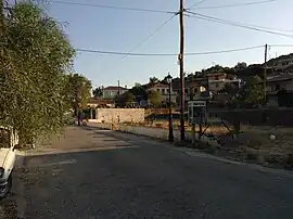 The village Kypseli | |
 Kypseli | |
| Coordinates: 37°36′N 23°23′E / 37.600°N 23.383°E | |
| Country | Greece |
| Administrative region | Attica |
| Regional unit | Islands |
| Municipality | Troizinia-Methana |
| Municipal unit | Methana |
| Elevation | 240 m (790 ft) |
| Population (2011)[1] | |
| • Rural | 47 |
| Community | |
| • Population | 92 (2011) |
| Time zone | UTC+2 (EET) |
| • Summer (DST) | UTC+3 (EEST) |
| Postal code | 180 30 |
| Area code(s) | 22980 |
Kypseli (Greek: Κυψέλη) is situated in the eastern part of the Methana volcanic peninsula. It was originally a farming village. The older name of the village is Kosona.[2] Kypseli community comprises also the village Agioi Theodoroi. The population of the village is 47 inhabitants, and the community population is 92 inhabitants according to 2011 census.
Historical population
| Census | Settlement | Community |
|---|---|---|
| 1991 | 108 | |
| 2001 | 94 | 169 |
| 2011 | 47 | 92 |
References
- 1 2 "Απογραφή Πληθυσμού - Κατοικιών 2011. ΜΟΝΙΜΟΣ Πληθυσμός" (in Greek). Hellenic Statistical Authority.
- ↑ "Κυψέλη". dimostroizinias-methanon.gr. Retrieved 15 July 2016.
This article is issued from Wikipedia. The text is licensed under Creative Commons - Attribution - Sharealike. Additional terms may apply for the media files.