Lavushimanda District | |
|---|---|
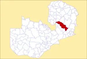 District location in Zambia | |
| Country | |
| Province | Muchinga Province |
| Area | |
| • Total | 5,252 km2 (2,028 sq mi) |
| Population (2018) | |
| • Total | 127,604 |
| • Density | 24/km2 (63/sq mi) |
| Time zone | UTC+2 (CAT) |
Lavushimanda District is a district of Muchinga Province, Zambia.[1][2] It was named after the Lavushi Manda National Park and separated from Mpika District in 2017.[3][4] It also contains a town centre of the same name (Lavushimanda) on the Great North Road.
References
- ↑ "Districts of Zambia". Statoids. Retrieved December 30, 2018.
- ↑ "Zambia: Administrative Division". citypopulation. Retrieved December 30, 2018.
- ↑ Editor, Chief (2018-01-22). "Zambia : Creation of new districts is irreversible-President Lungu". LusakaTimes.com. Retrieved 2019-04-22.
{{cite web}}:|last=has generic name (help) - ↑ "Pres. Lungu Creates 3 New Districts". Zambia Reports. 2017-03-05. Retrieved 2019-04-22.
| Central Province | |
|---|---|
| Copperbelt Province | |
| Eastern Province | |
| Luapula Province | |
| Lusaka Province | |
| Muchinga Province | |
| Northern Province | |
| North-Western Province | |
| Southern Province | |
| Western Province | |
This article is issued from Wikipedia. The text is licensed under Creative Commons - Attribution - Sharealike. Additional terms may apply for the media files.