Lhazê County
拉孜县 • ལྷ་རྩེ་རྫོང་། Lhatse, Liza | |
|---|---|
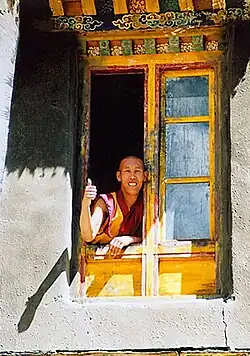 Old Lhatse Monastery | |
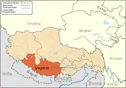
.png.webp) Location of Lhatse County (red) within Xigazê City (yellow) and Tibet | |
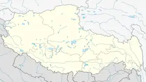 Lhatse Location of the seat in Tibet 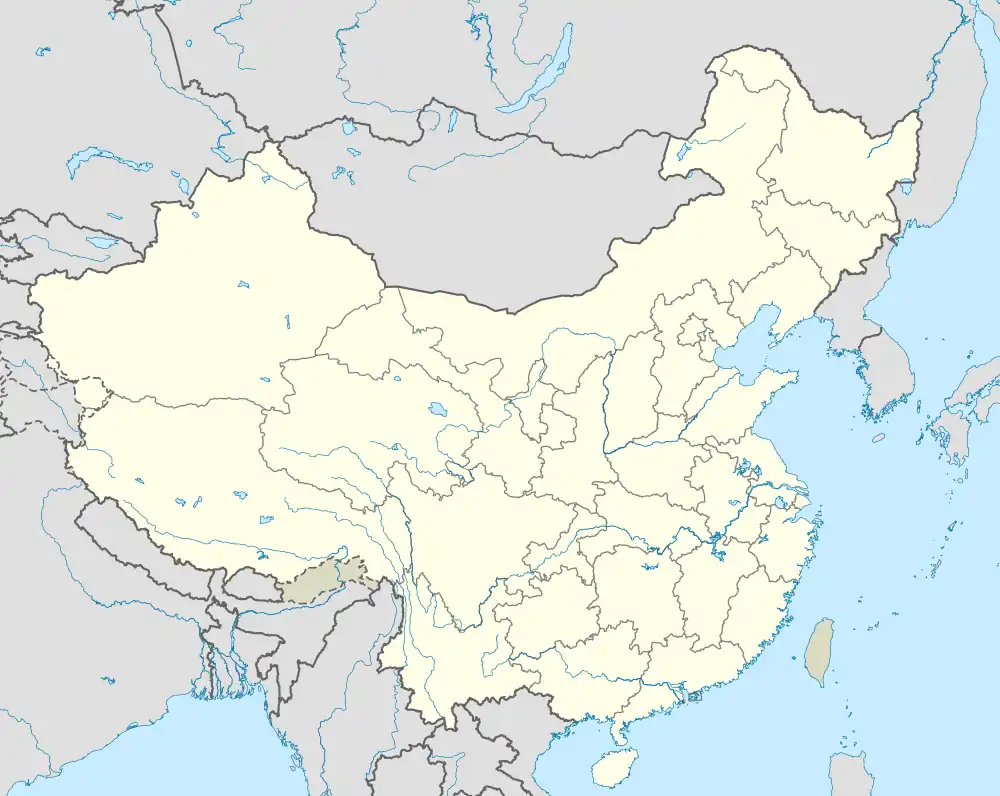 Lhatse Lhatse (China) | |
| Coordinates: 29°11′15″N 88°05′34″E / 29.18750°N 88.09278°E | |
| Country | China |
| Autonomous region | Tibet |
| Prefecture-level city | Xigazê |
| County seat | Quxar |
| Area | |
| • Total | 4,488.7 km2 (1,733.1 sq mi) |
| Population (2020)[1] | |
| • Total | 56,355 |
| • Density | 13/km2 (33/sq mi) |
| Time zone | UTC+8 (China Standard) |
| Website | www |
| Lhatse County | |||||||||||
|---|---|---|---|---|---|---|---|---|---|---|---|
| Chinese name | |||||||||||
| Simplified Chinese | 拉孜县 | ||||||||||
| Traditional Chinese | 拉孜縣 | ||||||||||
| |||||||||||
| Tibetan name | |||||||||||
| Tibetan | ལྷ་རྩེ་རྫོང་། | ||||||||||
| |||||||||||
Lhatse County is a county of Xigazê in the Tibet Autonomous Region, China. It was established in 1959, with Lhatse Town as the county seat. In 1968, Quxar Town became the county seat.[2]
Lhatse County, has a population of some 50,000 and is about 200 kilometers from Mount Everest (or Chomolungma). It is among the most impoverished counties in China.[3]
Administration divisions
Lhatse County is divided into 2 towns and 9 townships.[4][5]
| Name | Chinese | Hanyu Pinyin | Tibetan | Wylie | ||
|---|---|---|---|---|---|---|
| Towns | ||||||
| Quxar Town | 曲下镇 | Qǔxià zhèn | ཆུ་ཤར་གྲོང་རྡལ། | chu shar grong rdal | ||
| Lhazê Town | 拉孜镇 | Lāzī zhèn | ལྷ་རྩེ་གྲོང་རྡལ། | lha rtse grong rdal | ||
| Townships | ||||||
| Tashi Dzom Township | 扎西宗乡 | Zhāxīzōng xiāng | བཀྲ་ཤིས་འཛོམས་ཤང་། | bkra shis 'dzoms shang | ||
| Qoima Township | 曲玛乡 | Qǔmǎ xiāng | ཆོས་མ་ཤང་། | chos ma shang | ||
| Püncogling Township | 彭措林乡 | Péngcuòlín xiāng | ཕུན་ཚོགས་གླིང་ཤང་། | bon tshogs gling shang | ||
| Tashigang Township | 扎西岗乡 | Zhāxīgǎng xiāng | བཀྲ་ཤིས་སྒང་ཤང་། | bkra shis sgang shang | ||
| Liu Township | 柳乡 | Liǔ xiāng | སླེའུ་ཤང་། | sle'u shang | ||
| Resa Township | 热萨乡 | Rèsà xiāng | རེ་ས་ཤང་། | re sa shang | ||
| Xiqên Township | 锡钦乡 | Xīqīn xiāng | གཞིས་ཆེན་ཤང་། | gzhis chen shang | ||
| Mangpu Township | 芒普乡 | Mángpǔ xiāng | མང་ཕུ་ཤང་། | mang pu shang | ||
| Chau Township | 查务乡 | Cháwù xiāng | གྲའུ་ཤང་། | gra'u shang | ||
Climate
Lhatse County recorded the highest temperature of 28.9 °C (84.0 °F) in locations above 4,000 meters above sea level.
| Climate data for Lhatse (1991–2020 normals, extremes 1981–2010) | |||||||||||||
|---|---|---|---|---|---|---|---|---|---|---|---|---|---|
| Month | Jan | Feb | Mar | Apr | May | Jun | Jul | Aug | Sep | Oct | Nov | Dec | Year |
| Record high °C (°F) | 17.9 (64.2) |
18.5 (65.3) |
21.6 (70.9) |
22.7 (72.9) |
27.5 (81.5) |
28.7 (83.7) |
28.9 (84.0) |
27.0 (80.6) |
24.1 (75.4) |
22.1 (71.8) |
20.1 (68.2) |
19.6 (67.3) |
28.9 (84.0) |
| Mean daily maximum °C (°F) | 6.3 (43.3) |
7.9 (46.2) |
11.0 (51.8) |
14.6 (58.3) |
19.0 (66.2) |
22.7 (72.9) |
21.1 (70.0) |
19.7 (67.5) |
19.2 (66.6) |
16.0 (60.8) |
11.4 (52.5) |
8.2 (46.8) |
14.8 (58.6) |
| Daily mean °C (°F) | −1.7 (28.9) |
0.4 (32.7) |
3.9 (39.0) |
7.4 (45.3) |
11.6 (52.9) |
15.4 (59.7) |
14.6 (58.3) |
13.6 (56.5) |
12.6 (54.7) |
8.5 (47.3) |
3.1 (37.6) |
−0.4 (31.3) |
7.4 (45.3) |
| Mean daily minimum °C (°F) | −9.8 (14.4) |
−7.4 (18.7) |
−3.5 (25.7) |
0.4 (32.7) |
4.9 (40.8) |
9.2 (48.6) |
9.6 (49.3) |
8.8 (47.8) |
7.2 (45.0) |
1.6 (34.9) |
−5.0 (23.0) |
−8.8 (16.2) |
0.6 (33.1) |
| Record low °C (°F) | −19.1 (−2.4) |
−16.8 (1.8) |
−12.7 (9.1) |
−8.0 (17.6) |
−4.4 (24.1) |
1.0 (33.8) |
2.7 (36.9) |
2.6 (36.7) |
0.5 (32.9) |
−7.2 (19.0) |
−13.3 (8.1) |
−16.9 (1.6) |
−19.1 (−2.4) |
| Average precipitation mm (inches) | 0.2 (0.01) |
0.2 (0.01) |
0.3 (0.01) |
2.6 (0.10) |
14.7 (0.58) |
49.1 (1.93) |
123.6 (4.87) |
123.0 (4.84) |
38.2 (1.50) |
3.2 (0.13) |
0.2 (0.01) |
0.3 (0.01) |
355.6 (14) |
| Average precipitation days (≥ 0.1 mm) | 0.3 | 0.4 | 0.4 | 1.9 | 4.3 | 10.8 | 20.6 | 21.3 | 10.9 | 1.4 | 0.2 | 0.1 | 72.6 |
| Average snowy days | 0.5 | 0.7 | 0.8 | 2.6 | 1.5 | 0.1 | 0 | 0 | 0 | 0.4 | 0.3 | 0.2 | 7.1 |
| Average relative humidity (%) | 18 | 18 | 20 | 25 | 31 | 41 | 59 | 64 | 53 | 29 | 21 | 18 | 33 |
| Mean monthly sunshine hours | 254.1 | 239.2 | 272.3 | 272.3 | 300.1 | 268.8 | 209.9 | 202.7 | 237.5 | 290.9 | 268.9 | 264.6 | 3,081.3 |
| Percent possible sunshine | 78 | 75 | 73 | 70 | 71 | 64 | 50 | 50 | 65 | 83 | 85 | 83 | 71 |
| Source: China Meteorological Administration[6][7] | |||||||||||||
Transport
The county is a juncture of China National Highway 219 (G219) which goes to Kashgar and China National Highway 318 (G318) which ends at the border with Nepal. To the west along the G318, a road splits off and runs to the Mount Everest base camp.
Gallery
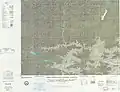 Map including Lhatse County area (ATC, 1971)
.jpg.webp)
References
- ↑ "日喀则市第七次全国人口普查主要数据公报" (in Chinese). Government of Xigazê. 2021-07-20.
- ↑ "Lhatse, Lhatse County – Lhatse Trip". China Travel Blogs – Tour-Beijing.com. 2011-09-01. Retrieved 2013-10-20.
- ↑ "Move to hospital deliveries saves mothers, infants in Tibet". Xinhua Writers Bai Xu and Hu Xing. 25 Feb. 2009
- ↑ 2022年统计用区划代码和城乡划分代码 (in Chinese). National Bureau of Statistics of the People's Republic of China.
- ↑ 汉藏对照工具书__西藏行政地名词典. 西藏藏语语言文字网 (in Chinese).
- ↑ 中国气象数据网 – WeatherBk Data (in Simplified Chinese). China Meteorological Administration. Retrieved 27 August 2023.
- ↑ 中国气象数据网 (in Simplified Chinese). China Meteorological Administration. Retrieved 27 August 2023.
| County-level divisions |
|  | ||||
|---|---|---|---|---|---|---|
| Settlements | ||||||
| Landmarks | ||||||
| Geography | ||||||
| Transport |
| |||||