Le Bourg-d'Iré | |
|---|---|
Part of Segré-en-Anjou Bleu | |
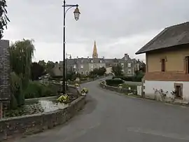 A general view of Le Bourg-d'Iré | |
Location of Le Bourg-d'Iré | |
 Le Bourg-d'Iré 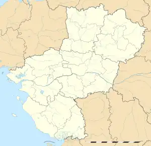 Le Bourg-d'Iré | |
| Coordinates: 47°40′52″N 0°57′57″W / 47.6811°N 0.9658°W | |
| Country | France |
| Region | Pays de la Loire |
| Department | Maine-et-Loire |
| Arrondissement | Segré |
| Canton | Segré |
| Commune | Segré-en-Anjou Bleu |
| Area 1 | 23.03 km2 (8.89 sq mi) |
| Population (2019)[1] | 827 |
| • Density | 36/km2 (93/sq mi) |
| Time zone | UTC+01:00 (CET) |
| • Summer (DST) | UTC+02:00 (CEST) |
| Postal code | 49520 |
| Elevation | 27–96 m (89–315 ft) (avg. 64 m or 210 ft) |
| 1 French Land Register data, which excludes lakes, ponds, glaciers > 1 km2 (0.386 sq mi or 247 acres) and river estuaries. | |
Le Bourg-d'Iré (French pronunciation: [lə buʁ diʁe] ⓘ) is a former commune in the Maine-et-Loire department in western France. On 15 December 2016, it was merged into the new commune Segré-en-Anjou Bleu.[2]
Geography
The river Verzée forms part of the commune's northwestern border, then flows east-southeast through the commune and crosses the village.
Population
|
|
See also
References
- ↑ Téléchargement du fichier d'ensemble des populations légales en 2019, INSEE
- ↑ Arrêté préfectoral 28 September 2016 (in French)
Wikimedia Commons has media related to Le Bourg-d'Iré.
This article is issued from Wikipedia. The text is licensed under Creative Commons - Attribution - Sharealike. Additional terms may apply for the media files.