| Malinovka | |
|---|---|
 | |
| Location | |
| Country | Russia |
| Region | Primorsky Krai |
| Physical characteristics | |
| Mouth | Bolshaya Ussurka |
• coordinates | 45°57′01″N 133°45′49″E / 45.95028°N 133.76361°E |
| Length | 274 km (170 mi) |
| Basin size | 6,490 km2 (2,510 sq mi) |
| Basin features | |
| Progression | Bolshaya Ussurka→ Ussuri→ Amur→ Sea of Okhotsk |
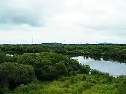
The Malinovka (Russian: Малиновка, formerly Вака Vaka or Ваку Vaku) is a river in Primorsky Krai, Russia, a left tributary of the Bolshaya Ussurka.
The area of the Malinovka drainage basin is approximately 6,490 square kilometres (2,510 sq mi).[1] The river is 274 kilometres (170 mi) long. The average depth of the river is 0.8 to 2.0 metres (2.6 to 6.6 ft).[2]
There are three hydrologic posts on the river near villages Ariadnoye, Rakitnoye and Vedenka. The longest tributary of the Malinovka is the Orekhovka, 80 kilometres (50 mi) long.
References
- ↑ "Река МАЛИНОВКА in the State Water Register of Russia". textual.ru (in Russian).
- ↑ Primpogoda.ru: Malinovka River
This article is issued from Wikipedia. The text is licensed under Creative Commons - Attribution - Sharealike. Additional terms may apply for the media files.