Mengersgereuth-Hämmern | |
|---|---|
 Coat of arms | |
Location of Mengersgereuth-Hämmern | |
 Mengersgereuth-Hämmern 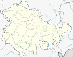 Mengersgereuth-Hämmern | |
| Coordinates: 50°23′N 11°7′E / 50.383°N 11.117°E | |
| Country | Germany |
| State | Thuringia |
| District | Sonneberg |
| Municipality | Frankenblick |
| Area | |
| • Total | 18.94 km2 (7.31 sq mi) |
| Elevation | 500 m (1,600 ft) |
| Population (2010-12-31) | |
| • Total | 2,724 |
| • Density | 140/km2 (370/sq mi) |
| Time zone | UTC+01:00 (CET) |
| • Summer (DST) | UTC+02:00 (CEST) |
| Postal codes | 96529 |
| Dialling codes | 03675 |
| Vehicle registration | SON |
| Website | www.mengersgereuth.de |
Mengersgereuth-Hämmern is a former municipality in the Sonneberg district of Thuringia, Germany. Since 1 January 2012, it is part of the municipality Frankenblick.
References
This article is issued from Wikipedia. The text is licensed under Creative Commons - Attribution - Sharealike. Additional terms may apply for the media files.