Nguru | |
|---|---|
 Nguru River Bank, Yobe State | |
 Nguru Location in Nigeria | |
| Coordinates: 12°52′45″N 10°27′09″E / 12.87917°N 10.45250°E | |
| Country | |
| State | Yobe State |
| Government | |
| • Local Government Chairman | Modu Kachalla (APC) |
| Area | |
| • Total | 916 km2 (354 sq mi) |
| Population (2006 census) | |
| • Total | 270,632 |
| Time zone | UTC+1 (WAT) |
| 3-digit postal code prefix | 630 |
| ISO 3166 code | NG.YO.NG |
Nguru (or N'Gourou) is a Local Government Area in Yobe State, Nigeria. Its headquarters are in the town of Nguru near the Hadejia River at 12°52′45″N 10°27′09″E / 12.87917°N 10.45250°E.
It has an area of 916 km2 and a population of 270,632 at the local government there is college of education and legal studies.
The postal code of the area is 630.[1]
The town probably dates from around the 15th century. There is a variety of landscape types in the area, including the protected Hadejia-Nguru wetlands of Nguru Lake, and the "Sand Dunes", a semi-desert area.
Climate
| Climate data for Nguru, Nigeria (1951–1960, precipitation 1947–1970) | |||||||||||||
|---|---|---|---|---|---|---|---|---|---|---|---|---|---|
| Month | Jan | Feb | Mar | Apr | May | Jun | Jul | Aug | Sep | Oct | Nov | Dec | Year |
| Record high °C (°F) | 39.0 (102.2) |
41.0 (105.8) |
43.0 (109.4) |
44.0 (111.2) |
43.5 (110.3) |
41.5 (106.7) |
38.5 (101.3) |
35.5 (95.9) |
38.0 (100.4) |
39.5 (103.1) |
39.0 (102.2) |
38.0 (100.4) |
44.0 (111.2) |
| Mean daily maximum °C (°F) | 31.0 (87.8) |
33.9 (93.0) |
38.0 (100.4) |
40.1 (104.2) |
39.2 (102.6) |
36.8 (98.2) |
32.4 (90.3) |
30.6 (87.1) |
32.4 (90.3) |
35.9 (96.6) |
35.2 (95.4) |
31.4 (88.5) |
34.7 (94.5) |
| Daily mean °C (°F) | 21.8 (71.2) |
24.2 (75.6) |
28.4 (83.1) |
30.9 (87.6) |
31.7 (89.1) |
30.4 (86.7) |
27.4 (81.3) |
26.2 (79.2) |
27.2 (81.0) |
27.9 (82.2) |
25.9 (78.6) |
22.4 (72.3) |
27.0 (80.6) |
| Mean daily minimum °C (°F) | 12.7 (54.9) |
14.4 (57.9) |
18.9 (66.0) |
21.7 (71.1) |
24.2 (75.6) |
24.0 (75.2) |
22.5 (72.5) |
21.8 (71.2) |
22.0 (71.6) |
19.9 (67.8) |
16.6 (61.9) |
13.3 (55.9) |
19.3 (66.7) |
| Record low °C (°F) | 5.5 (41.9) |
6.0 (42.8) |
11.0 (51.8) |
12.0 (53.6) |
17.0 (62.6) |
18.0 (64.4) |
19.0 (66.2) |
18.0 (64.4) |
17.0 (62.6) |
13.5 (56.3) |
10.5 (50.9) |
5.0 (41.0) |
5.0 (41.0) |
| Average precipitation mm (inches) | 0 (0) |
0 (0) |
0 (0) |
2 (0.1) |
27 (1.1) |
65 (2.6) |
140 (5.5) |
210 (8.3) |
83 (3.3) |
9 (0.4) |
2 (0.1) |
0 (0) |
538 (21.2) |
| Average precipitation days (≥ 0.3 mm) | 0 | 0 | 0 | 0 | 3 | 6 | 11 | 15 | 7 | 1 | 0 | 0 | 43 |
| Average relative humidity (%) (at 07:00 LST) | 37 | 34 | 32 | 38 | 61 | 74 | 86 | 92 | 91 | 74 | 42 | 40 | 58 |
| Source: Deutscher Wetterdienst[2] | |||||||||||||
Transport
Nguru is the terminus of the Western Railway of Nigeria.
See also
See also
References
- ↑ "Post Offices- with map of LGA". NIPOST. Archived from the original on 2012-11-26. Retrieved 2009-10-20.
- ↑ "Klimatafel von Nguru / Nigeria" (PDF). Baseline climate means (1961-1990) from stations all over the world (in German). Deutscher Wetterdienst. Retrieved 10 August 2016.
State capital: Damaturu | ||
| Local Government Areas | 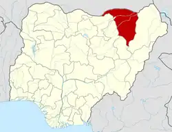 | |
This article is issued from Wikipedia. The text is licensed under Creative Commons - Attribution - Sharealike. Additional terms may apply for the media files.