North Channel Bridge | |
|---|---|
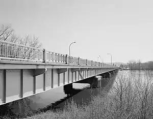 North Channel Bridge, looking southeast from the north approach. | |
| Coordinates | 44°03′44″N 91°38′15″W / 44.06222°N 91.63750°W |
| Carries | Two lanes of |
| Crosses | Mississippi River |
| Locale | Winona, Minnesota |
| ID number | B-06-0752 (Wisconsin), 5930 (Minnesota) |
| Characteristics | |
| Design | Concrete girder bridge |
| Total length | 1,008 feet (307 m) |
| Width | 61 feet (19 m) |
| Longest span | 101 feet (31 m) |
| Clearance below | 20 feet (6.1 m) |
| History | |
| Opened | 1997 |
| Location | |
The North Channel Bridge crosses the north channel of the Mississippi River between Latsch Island (part of Winona, Minnesota) and Buffalo County, Wisconsin.
The bridge has a street setup, with one lane in either direction. It carries Minnesota State Highway 43 and WI 54 in either direction. Immediately to the southwest is the Main Channel Bridge.
Images
 Looking southwest along the center line
 Looking northeast along the centerline
See also
References
- Costello, Mary Charlotte (2002). Climbing the Mississippi River Bridge by Bridge, Volume Two: Minnesota. Cambridge, MN: Adventure Publications. ISBN 0-9644518-2-4.
External links
- Historic American Engineering Record (HAER) No. MN-91, "Bridge No. 5930, Spanning Mississippi River at Trunk Highway 43, Winona, Winona County, MN", 57 photos, 15 data pages, 5 photo caption pages, includes both Main Channel and North Channel bridges
Crossings of the Mississippi River | ||||
|---|---|---|---|---|
| ||||
This article is issued from Wikipedia. The text is licensed under Creative Commons - Attribution - Sharealike. Additional terms may apply for the media files.