Paese | |
|---|---|
| Comune di Paese | |
Location of Paese | |
 Paese Location of Paese in Italy 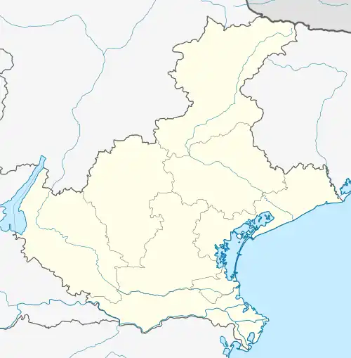 Paese Paese (Veneto) | |
| Coordinates: 45°40′N 12°9′E / 45.667°N 12.150°E | |
| Country | Italy |
| Region | Veneto |
| Province | Province of Treviso (TV) |
| Frazioni | Castagnole, Padernello, Porcellengo, Postioma |
| Area | |
| • Total | 38.0 km2 (14.7 sq mi) |
| Highest elevation | 73 m (240 ft) |
| Lowest elevation | 12 m (39 ft) |
| Population (January 2015)[2] | |
| • Total | 22,020 |
| • Density | 580/km2 (1,500/sq mi) |
| Time zone | UTC+1 (CET) |
| • Summer (DST) | UTC+2 (CEST) |
| Postal code | 31038 |
| Dialing code | 0422 |
| Website | Official website |
Paese (Venetian: Paexe) is a comune (municipality) in the Province of Treviso in the Italian region Veneto, located about 30 kilometres (19 mi) northwest of Venice and about 8 kilometres (5 mi) west of Treviso. As of 31 December 2004, it had a population of 19,898 and an area of 38.0 square kilometres (14.7 sq mi).[3]
Geography
The municipality of Paese contains the frazioni (subdivisions, mainly villages and hamlets) of Castagnole, Padernello, Porcellengo and Postioma.
Paese borders the following municipalities: Istrana, Morgano, Ponzano Veneto, Quinto di Treviso, Trevignano, Treviso, Volpago del Montello.
The people of Paese speak both Italian and Venetian Language (the dialect of the Veneto region).
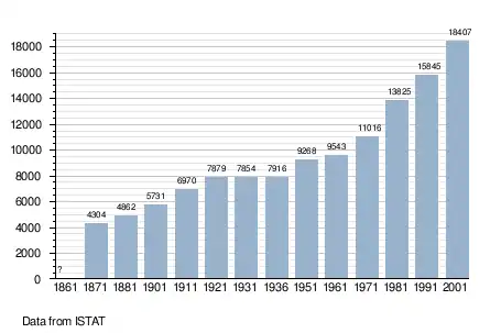
Demographic evolution
References
- ↑ "Superficie di Comuni Province e Regioni italiane al 9 ottobre 2011". Italian National Institute of Statistics. Retrieved 16 March 2019.
- ↑ "Popolazione Residente al 1° Gennaio 2018". Italian National Institute of Statistics. Retrieved 16 March 2019.
- ↑ All demographics and other statistics: Italian statistical institute Istat.
External links
![]() Media related to Paese (comune, Italy) at Wikimedia Commons
Media related to Paese (comune, Italy) at Wikimedia Commons
- (in Italian) Paese official website