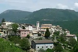
Poggiodomo | |
|---|---|
| Comune di Poggiodomo | |
 | |
 Coat of arms | |
Location of Poggiodomo | |
 Poggiodomo Location of Poggiodomo in Italy 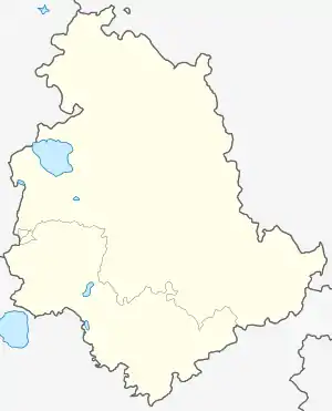 Poggiodomo Poggiodomo (Umbria) | |
| Coordinates: 42°43′N 12°56′E / 42.717°N 12.933°E | |
| Country | Italy |
| Region | Umbria |
| Province | Perugia (PG) |
| Frazioni | Mucciafora, Roccatamburo, Usigni |
| Government | |
| • Mayor | Filippo Marini |
| Area | |
| • Total | 40.09 km2 (15.48 sq mi) |
| Elevation | 974 m (3,196 ft) |
| Population | |
| • Total | 106 |
| • Density | 2.6/km2 (6.8/sq mi) |
| Demonym | Pojani (Poiani) |
| Time zone | UTC+1 (CET) |
| • Summer (DST) | UTC+2 (CEST) |
| Postal code | 06040 |
| Dialing code | 0743 |
| Patron saint | St. Anthony of Padua |
| Saint day | Last week of August |
| Website | Official website |
Poggiodomo is a comune (municipality) in the Province of Perugia in the Italian region Umbria, located about 80 km southeast of Perugia.
Poggiodomo borders the following municipalities: Cascia, Cerreto di Spoleto, Monteleone di Spoleto, Sant'Anatolia di Narco, Vallo di Nera.
References
- ↑ "Superficie di Comuni Province e Regioni italiane al 9 ottobre 2011". Italian National Institute of Statistics. Retrieved 16 March 2019.
- ↑ All demographics and other statistics: Italian statistical institute Istat.
- ↑ "Popolazione Residente al 1° Gennaio 2018". Italian National Institute of Statistics. Retrieved 16 March 2019.
External links
This article is issued from Wikipedia. The text is licensed under Creative Commons - Attribution - Sharealike. Additional terms may apply for the media files.