Sartu District
萨尔图区 | |
|---|---|
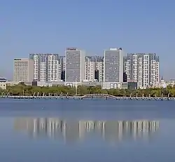 Wanbao Lake in Sartu District, Daqing | |
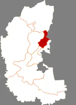 Sartu in Daqing | |
.png.webp) Daqing in Heilongjiang | |
| Coordinates: 46°35′47″N 125°06′53″E / 46.5964°N 125.1146°E | |
| Country | China |
| Province | Heilongjiang |
| Prefecture-level city | Daqing |
| District seat | Gelin Subdistrict |
| Area | |
| • Total | 549 km2 (212 sq mi) |
| Population (2020 census)[1] | |
| • Total | 327,192 |
| • Density | 600/km2 (1,500/sq mi) |
| Time zone | UTC+8 (China Standard) |
| Website | www |
Sartu District (simplified Chinese: 萨尔图区; traditional Chinese: 薩爾圖區; pinyin: Sà'ěrtú Qū, literal meaning in Mongolian: where the moon rise) is a district of Daqing, Heilongjiang province, China.
Administrative divisions
Sartu District is divided into 11 subdistricts.[2]
Sartu (萨尔图街道), Huizhan (会战街道), Youyi (友谊街道), Dong'an (东安街道), Dongfeng (东风街道), Tieren (铁人街道), Huoju (火炬街道), Yongjun (拥军街道), Wanbao (万宝街道), Gelin (格林街道), Lüyuan (绿园街道)
Notes and references
- ↑ "2020年大庆市第七次全国人口普查主要数据公报" (in Chinese). Daqing Municipal People's Government. 2021-06-01.
- ↑ ":zh:2022年统计用区划代码" (in Chinese). National Bureau of Statistics of the People's Republic of China.
External links
- (in Chinese) Government site - Google translation
This article is issued from Wikipedia. The text is licensed under Creative Commons - Attribution - Sharealike. Additional terms may apply for the media files.