| Schwengeberg | |
|---|---|
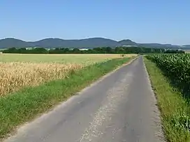 View from a driveway at the Hertingshausen grill hut (at the Hertingshausen brook, near K 22) west-northwest to the Langenberge: Bensberg (left), Laufskopf (center left), Schwengeberg (center right) and Burgberg (right). | |
| Highest point | |
| Elevation | 556.7 m (1,826 ft) |
| Coordinates | 51°14′59″N 9°20′34″E / 51.24972°N 9.34278°E |
| Geography | |
| Location | Schwalm-Eder-Kreis, Hesse, Germany |
Schwengeberg is a mountain of Schwalm-Eder-Kreis, Hesse, Germany.
This article is issued from Wikipedia. The text is licensed under Creative Commons - Attribution - Sharealike. Additional terms may apply for the media files.