40°27′55″N 43°55′47″E / 40.46528°N 43.92972°E
Shenik Շենիկ | |
|---|---|
 Former settlement of Shenik | |
 Shenik Շենիկ | |
| Coordinates: 40°26′40″N 43°56′00″E / 40.44444°N 43.93333°E | |
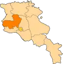
| Country | Armenia |
| Marz (Province) | Aragatsotn |
| Time zone | UTC+4 ( ) |
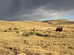
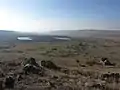
Shenik is a former settlement and an abandoned village in the Aragatsotn Province of Armenia. It is 3 km east of the Mastara village, and is home to the 5th-century church of Surp Amenaprkich (Holy Saviour), and the 7th-century church of Surp Astvatsatsin (Holy Mother of God).
Gallery
 Settlement Shenik, general view
_Church4.jpg.webp) Settlement Shenik, Surb Astvatsatsin (Surb Sargis) Church
Settlement Shenik, Surb Astvatsatsin (Surb Sargis) Church_Church3.jpg.webp) Surb Astvatsatsin (Surb Sargis) Church
Surb Astvatsatsin (Surb Sargis) Church_Church2.jpg.webp) Surb Astvatsatsin (Surb Sargis) Church
Surb Astvatsatsin (Surb Sargis) Church_Church1.jpg.webp) Surb Astvatsatsin (Surb Sargis) Church
Surb Astvatsatsin (Surb Sargis) Church_Church5.jpg.webp) Surb Astvatsatsin (Surb Sargis) Church
Surb Astvatsatsin (Surb Sargis) Church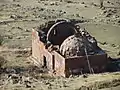 Settlement Shenik, Surb Amenaprkich Church
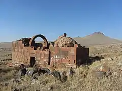 Surb Amenaprkich Church
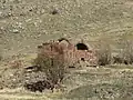 Surb Amenaprkich Church
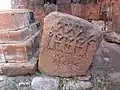 Surb Amenaprkich Church, tombstone
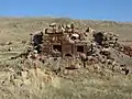 Settlement Shenik
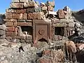 Settlement Shenik
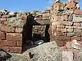 Settlement Shenik
References
- Kiesling, Rediscovering Armenia, p. 19, available online at the US embassy to Armenia's website
This article is issued from Wikipedia. The text is licensed under Creative Commons - Attribution - Sharealike. Additional terms may apply for the media files.