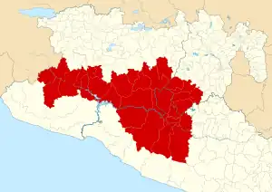
Map showing the Tierra Caliente region
Tierra Caliente (Spanish for Hot Land) is a cultural and geographical region in southern Mexico that comprises some low-elevation areas of the states of Michoacán, Guerrero and Mexico. As the name suggests, the region is characterized by a hot climate. The overall precipitation is also low - around 600 mm/year, but can be as low as 400 mm in some low-lying areas of Michoacán and Guerrero.
Municipalities
Guerrero
State of Mexico (Edomex)
| Name | Municipal seat |
|---|---|
| Amatepec | Amatepec |
| Luvianos | Villa Luvianos |
| Sultepec | Sultepec de Pedro Ascencio de Alquisiras |
| Tejupilco | Tejupilco de Hidalgo |
| Tlatlaya | Tlatlaya |
Sources
References
- Entregan recursos de Codecos a las regiones Oriente y Tierra Caliente. State of Michoacán.
- Acuña, R. (1987). Relaciones Geográficas del Siglo XVI: Michoacán. Universidad Nacional Autónoma de México.
- Gerhard, P. (1972). A Guide to the Historical Geography of New Spain. University of Cambridge Press.
- Sebastian Avellaneda Jr. (2013). Information over San Lucas, Michoacán. Ohio Valley University, WV.
This article is issued from Wikipedia. The text is licensed under Creative Commons - Attribution - Sharealike. Additional terms may apply for the media files.