Tocumen | |
|---|---|
 Tocumen | |
| Coordinates: 9°4′48″N 79°22′48″W / 9.08000°N 79.38000°W | |
| Country | |
| Province | Panamá |
| District | Panamá |
| Area | |
| • Land | 63.9 km2 (24.7 sq mi) |
| Population (2010)[1] | |
| • Total | 74,952 |
| • Density | 1,173.9/km2 (3,040/sq mi) |
| Population density calculated based on land area. | |
| Time zone | UTC−5 (EST) |
Tocumen is a city and corregimiento in Panamá District, Panamá Province, Panama with a population of 74,952 as of 2010.[1] Its population as of 1990 was 47,032; its population as of 2000 was 83,187.[1] It is the site of the Tocumen International Airport.
Climate
According to the Köppen Climate Classification system, Tocumen has a tropical monsoon climate, abbreviated "Am" on climate maps.
| Climate data for Tocumen | |||||||||||||
|---|---|---|---|---|---|---|---|---|---|---|---|---|---|
| Month | Jan | Feb | Mar | Apr | May | Jun | Jul | Aug | Sep | Oct | Nov | Dec | Year |
| Mean daily maximum °C (°F) | 36.0 (96.8) |
36.6 (97.9) |
37.0 (98.6) |
37.6 (99.7) |
38.0 (100.4) |
38.0 (100.4) |
36.0 (96.8) |
38.0 (100.4) |
35.4 (95.7) |
35.2 (95.4) |
35.0 (95.0) |
35.5 (95.9) |
36.5 (97.8) |
| Daily mean °C (°F) | 26.6 (79.9) |
27.0 (80.6) |
27.5 (81.5) |
27.8 (82.0) |
27.4 (81.3) |
27.0 (80.6) |
27.0 (80.6) |
27.0 (80.6) |
26.7 (80.1) |
26.4 (79.5) |
26.5 (79.7) |
26.6 (79.9) |
27.0 (80.5) |
| Mean daily minimum °C (°F) | 16.5 (61.7) |
16.0 (60.8) |
16.0 (60.8) |
15.8 (60.4) |
19.0 (66.2) |
19.5 (67.1) |
19.7 (67.5) |
17.5 (63.5) |
20.0 (68.0) |
17.8 (64.0) |
18.5 (65.3) |
17.0 (62.6) |
17.8 (64.0) |
| Average rainfall mm (inches) | 26.4 (1.04) |
10.0 (0.39) |
15.2 (0.60) |
69.6 (2.74) |
231.6 (9.12) |
234.7 (9.24) |
172.4 (6.79) |
218.0 (8.58) |
246.8 (9.72) |
326.3 (12.85) |
240.9 (9.48) |
100.6 (3.96) |
1,892.5 (74.51) |
| Average relative humidity (%) | 69.6 | 66.1 | 64.9 | 67.7 | 78.2 | 80.6 | 79.6 | 80.3 | 81.2 | 82.4 | 81.9 | 75.3 | 75.6 |
| Mean monthly sunshine hours | 211.9 | 203.7 | 211.2 | 179.6 | 127.5 | 97.4 | 110.5 | 111.9 | 113.2 | 114.3 | 126.6 | 171.3 | 1,779.1 |
| Source: [2] | |||||||||||||
References
- 1 2 3 4 "Cuadro 11 (Superficie, población y densidad de población en la República...)" [Table 11 (Area, population, and population density in the Republic...)] (.xls). In "Resultados Finales Básicos" [Basic Final Results] (in Spanish). National Institute of Statistics and Census of Panama. Retrieved May 26, 2015.
- ↑ "Datos Historicos- Hidrometeorologica de ETESA". ETESA. Retrieved October 9, 2012.
Capital: Panama | ||
| Balboa District | 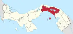 | |
| Chepo District | ||
| Chimán District | ||
| Panamá District | ||
| San Miguelito District | ||
| Taboga District | ||
This article is issued from Wikipedia. The text is licensed under Creative Commons - Attribution - Sharealike. Additional terms may apply for the media files.