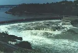
Great Falls of the Missouri
There are at least 120 named waterfalls in Montana. A waterfall is a place where flowing water rapidly drops in elevation as it flows over a steep region or a cliff. Waterfalls are most commonly formed when a river is young.[1]
- Akaiyan Falls, Flathead County, Montana, 48°36′51″N 113°47′05″W / 48.61417°N 113.78472°W, el. 6,985 feet (2,129 m)[2]
- Alpine Falls, Gallatin County, Montana, 45°23′34″N 110°57′11″W / 45.39278°N 110.95306°W, el. 8,802 feet (2,683 m)[3]
- Apex Falls, Gallatin County, Montana, 45°23′50″N 110°57′22″W / 45.39722°N 110.95611°W, el. 8,281 feet (2,524 m)[4]
- Apikuni Falls, Glacier County, Montana, 48°48′51″N 113°38′33″W / 48.81417°N 113.64250°W, el. 5,522 feet (1,683 m)[5]
- Appistoki Falls, Glacier County, Montana, 48°28′55″N 113°21′09″W / 48.48194°N 113.35250°W, el. 5,512 feet (1,680 m)[6]
- Arch Falls, Gallatin County, Montana, 45°25′38″N 110°57′40″W / 45.42722°N 110.96111°W, el. 7,342 feet (2,238 m)[7]
- Atlantic Falls, Glacier County, Montana, 48°34′26″N 113°27′02″W / 48.57389°N 113.45056°W, el. 5,367 feet (1,636 m)[8]
- Atsina Falls, Glacier County, Montana, 48°52′25″N 113°51′02″W / 48.87361°N 113.85056°W, el. 6,247 feet (1,904 m)[9]
- Baring Falls, Glacier County, Montana, 48°40′37″N 113°35′35″W / 48.67694°N 113.59306°W, el. 4,564 feet (1,391 m)[10]
- Barrier Falls, Missoula County, Montana, 47°34′00″N 113°29′43″W / 47.56667°N 113.49528°W, el. 4,459 feet (1,359 m)[11]
- Beaver Chief Falls, Flathead County, Montana, 48°35′38″N 113°45′52″W / 48.59389°N 113.76444°W, el. 5,262 feet (1,604 m)[12]
- Beaver Medicine Falls, Flathead County, Montana, 48°36′06″N 113°47′46″W / 48.60167°N 113.79611°W, el. 5,545 feet (1,690 m)[13]
- Big Falls, Cascade County, Montana, 47°34′12″N 111°07′23″W / 47.57000°N 111.12306°W, el. 3,012 feet (918 m)[14]
- Big Salmon Falls, Missoula County, Montana, 47°30′47″N 113°30′44″W / 47.51306°N 113.51222°W, el. 5,531 feet (1,686 m)[15]
- Bird Woman Falls, Flathead County, Montana, 48°42′29″N 113°44′51″W / 48.70806°N 113.74750°W, el. 5,751 feet (1,753 m)[16]
- Black Eagle Falls, Cascade County, Montana, 47°31′15″N 111°15′43″W / 47.52083°N 111.26194°W, el. 3,278 feet (999 m)[17]
- Boulder Falls, Ravalli County, Montana, 45°51′35″N 114°18′29″W / 45.85972°N 114.30806°W, el. 5,502 feet (1,677 m)[18]
- Buffalo Falls, Cascade County, Montana, 47°21′49″N 111°54′27″W / 47.36361°N 111.90750°W, el. 3,816 feet (1,163 m)[19]
- Calamity Falls, Carbon County, Montana, 45°09′43″N 109°31′13″W / 45.16194°N 109.52028°W, el. 8,182 feet (2,494 m)[20]
- Canyon Falls (Montana), Ravalli County, Montana, 46°14′43″N 114°19′15″W / 46.24528°N 114.32083°W, el. 7,054 feet (2,150 m)[21]
- Cascade Falls, Sanders County, Montana, 47°18′10″N 114°49′35″W / 47.30278°N 114.82639°W, el. 2,943 feet (897 m)[22]
- Cascade Falls, Park County, Montana, 45°28′11″N 110°33′37″W / 45.46972°N 110.56028°W, el. 5,568 feet (1,697 m)[23]
- Castner Falls, Cascade County, Montana, 47°18′17″N 111°29′49″W / 47.30472°N 111.49694°W, el. 3,543 feet (1,080 m)[24]
- Cataract Falls, Lewis and Clark County, Montana, 47°19′19″N 112°36′14″W / 47.32194°N 112.60389°W, el. 5,321 feet (1,622 m)[25]
- Cedar Falls, Madison County, Montana, 45°14′19″N 111°31′02″W / 45.23861°N 111.51722°W, el. 9,311 feet (2,838 m)[26]
- Champagne Falls, Gallatin County, Montana, 45°24′28″N 110°57′30″W / 45.40778°N 110.95833°W, el. 7,808 feet (2,380 m)[27]
- Charlie Falls, Carbon County, Montana, 45°07′20″N 109°43′28″W / 45.12222°N 109.72444°W, el. 8,445 feet (2,574 m)[28]
- Colter Falls (historical), Cascade County, Montana, 47°32′15″N 111°12′53″W / 47.53750°N 111.21472°W, el. 3,251 feet (991 m)[29]
- Crooked Falls, Cascade County, Montana, 47°32′10″N 111°11′47″W / 47.53611°N 111.19639°W, el. 3,136 feet (956 m)[30]
- Crow Creek Falls, Jefferson County, Montana, 46°20′17″N 111°47′27″W / 46.33806°N 111.79083°W, el. 5,636 feet (1,718 m)[31]
- Dawn Mist Falls, Glacier County, Montana, 48°54′31″N 113°43′18″W / 48.90861°N 113.72167°W, el. 4,711 feet (1,436 m)[32]
- Dawson Falls, Glacier County, Montana, 48°25′24″N 113°12′32″W / 48.42333°N 113.20889°W, el. 4,734 feet (1,443 m)[33]
- Deadwood Falls, Glacier County, Montana, 48°40′00″N 113°38′13″W / 48.66667°N 113.63694°W, el. 4,642 feet (1,415 m)[34]
- Dean Falls, Flathead County, Montana, 47°52′39″N 113°12′44″W / 47.87750°N 113.21222°W, el. 4,616 feet (1,407 m)[35]
- Double Falls, Lewis and Clark County, Montana, 47°24′25″N 112°43′26″W / 47.40694°N 112.72389°W, el. 5,298 feet (1,615 m)[36]
- Elizabeth Falls, Lake County, Montana, 47°20′21″N 113°55′43″W / 47.33917°N 113.92861°W, el. 5,919 feet (1,804 m)[37]
- Feather Plume Falls, Glacier County, Montana, 48°45′04″N 113°42′09″W / 48.75111°N 113.70250°W, el. 6,256 feet (1,907 m)[38]
- Feather Woman Falls, Flathead County, Montana, 48°36′42″N 113°46′44″W / 48.61167°N 113.77889°W, el. 7,192 feet (2,192 m)[39]
- Florence Falls, Glacier County, Montana, 48°39′04″N 113°41′33″W / 48.65111°N 113.69250°W, el. 4,980 feet (1,520 m)[40]
- Graves Creek Falls, Sanders County, Montana, 47°43′12″N 115°22′44″W / 47.72000°N 115.37889°W, el. 2,835 feet (864 m)[41]
- Grinnell Falls, Glacier County, Montana, 48°45′45″N 113°43′13″W / 48.76250°N 113.72028°W, el. 5,955 feet (1,815 m)[42]
- Gros Ventre Falls, Glacier County, Montana, 48°55′49″N 113°44′22″W / 48.93028°N 113.73944°W, el. 4,800 feet (1,500 m)[43]
- Grotto Falls, Gallatin County, Montana, 45°26′09″N 110°57′50″W / 45.43583°N 110.96389°W, el. 7,146 feet (2,178 m)[44]
- Hidden Falls, Glacier County, Montana, 48°45′57″N 113°41′44″W / 48.76583°N 113.69556°W, el. 4,977 feet (1,517 m)[45]
- Hole-in-the Wall Falls, Flathead County, Montana, 48°57′43″N 114°04′05″W / 48.96194°N 114.06806°W, el. 6,256 feet (1,907 m)[46]
- Hoodoo Cascade, Gallatin County, Montana, 45°22′59″N 111°14′43″W / 45.38306°N 111.24528°W, el. 6,985 feet (2,129 m)[47]
- Horsetail Falls, Park County, Montana, 45°26′27″N 110°54′59″W / 45.44083°N 110.91639°W, el. 8,389 feet (2,557 m)[48]
- Impasse Falls, Carbon County, Montana, 45°07′04″N 109°44′33″W / 45.11778°N 109.74250°W, el. 9,009 feet (2,746 m)[49]
- Ipasha Falls, Glacier County, Montana, 48°50′55″N 113°48′26″W / 48.84861°N 113.80722°W, el. 6,283 feet (1,915 m)[50]
- Knowles Falls, Park County, Montana, 45°00′42″N 110°35′41″W / 45.01167°N 110.59472°W, el. 5,558 feet (1,694 m)[51]
- Kootenai Falls, Lincoln County, Montana, 48°27′20″N 115°45′48″W / 48.45556°N 115.76333°W, el. 1,972 feet (601 m)[52]
- Lange Falls, Lewis and Clark County, Montana, 47°36′10″N 112°50′06″W / 47.60278°N 112.83500°W, el. 5,020 feet (1,530 m)[53]
- Little North Fork Falls, Lincoln County, Montana, 48°45′36″N 115°22′33″W / 48.76000°N 115.37583°W, el. 3,061 feet (933 m)[54]
- Lost Creek Falls, Mineral County, Montana, 47°06′46″N 115°07′13″W / 47.11278°N 115.12028°W, el. 5,302 feet (1,616 m)[55]
- Lower Falls, Lincoln County, Montana, 48°56′08″N 115°40′54″W / 48.93556°N 115.68167°W, el. 3,123 feet (952 m)[56]
- Martin Falls, Flathead County, Montana, 48°34′01″N 114°41′11″W / 48.56694°N 114.68639°W, el. 3,753 feet (1,144 m)[57]
- McDonald Falls, Flathead County, Montana, 48°38′25″N 113°51′47″W / 48.64028°N 113.86306°W, el. 3,225 feet (983 m)[58]
- Memorial Falls (Montana), Cascade County, Montana, 46°54′55″N 110°41′35″W / 46.91528°N 110.69306°W, el. 6,188 feet (1,886 m)[59]
- Miche Wabun Falls, Glacier County, Montana, 48°58′58″N 113°46′16″W / 48.98278°N 113.77111°W, el. 5,548 feet (1,691 m)[60]
- Mill Falls, Teton County, Montana, 47°51′32″N 112°46′31″W / 47.85889°N 112.77528°W, el. 5,781 feet (1,762 m)[61]
- Mission Falls, Lake County, Montana, 47°20′12″N 113°56′21″W / 47.33667°N 113.93917°W, el. 4,941 feet (1,506 m)[62]
- Mokowanis Cascade, Glacier County, Montana, 48°52′36″N 113°50′28″W / 48.87667°N 113.84111°W, el. 5,676 feet (1,730 m)[63]
- Monture Falls, Powell County, Montana, 47°15′53″N 113°10′33″W / 47.26472°N 113.17583°W, el. 5,449 feet (1,661 m)[64]
- Monument Falls, Flathead County, Montana, 48°39′00″N 113°46′19″W / 48.65000°N 113.77194°W, el. 4,272 feet (1,302 m)[65]
- Morning Eagle Falls, Glacier County, Montana, 48°44′09″N 113°41′50″W / 48.73583°N 113.69722°W, el. 5,709 feet (1,740 m)[66]
- Morrell Falls, Powell County, Montana, 47°18′04″N 113°27′46″W / 47.30111°N 113.46278°W, el. 5,007 feet (1,526 m)[67]
- Mud Creek Falls, Lake County, Montana, 47°36′58″N 114°00′21″W / 47.61611°N 114.00583°W, el. 5,154 feet (1,571 m)[68]
- Needle Falls, Flathead County, Montana, 47°36′42″N 113°12′18″W / 47.61167°N 113.20500°W, el. 5,190 feet (1,580 m)[69]
- North Fork Falls, Lewis and Clark County, Montana, 47°11′39″N 112°53′41″W / 47.19417°N 112.89472°W, el. 5,407 feet (1,648 m)[70]
- Oberlin Falls, Flathead County, Montana, 48°41′59″N 113°43′24″W / 48.69972°N 113.72333°W, el. 6,480 feet (1,980 m)[71]
- Ousel Falls, Gallatin County, Montana, 45°14′21″N 111°20′30″W / 45.23917°N 111.34167°W, el. 6,614 feet (2,016 m)[72]
- Overwhich Falls, Ravalli County, Montana, 45°43′07″N 114°04′38″W / 45.71861°N 114.07722°W, el. 6,529 feet (1,990 m)[73]
- Paiota Falls, Glacier County, Montana, 48°52′19″N 113°50′59″W / 48.87194°N 113.84972°W, el. 6,240 feet (1,900 m)[74]
- Palisade Falls, Gallatin County, Montana, 45°28′18″N 110°56′11″W / 45.47167°N 110.93639°W, el. 7,060 feet (2,150 m)[75]
- Palisades Falls, Gallatin County, Montana, 45°28′15″N 110°55′43″W / 45.47083°N 110.92861°W, el. 7,490 feet (2,280 m)[76]
- Paradise Falls, Lewis and Clark County, Montana, 46°45′06″N 112°27′50″W / 46.75167°N 112.46389°W, el. 5,377 feet (1,639 m)[77]
- Passage Falls, Park County, Montana, 45°14′32″N 110°29′50″W / 45.24222°N 110.49722°W, el. 6,440 feet (1,960 m)[78]
- Piegan Falls, Glacier County, Montana, 48°42′37″N 113°40′38″W / 48.71028°N 113.67722°W, el. 6,962 feet (2,122 m)[79]
- Pinkham Falls, Lincoln County, Montana, 48°50′21″N 115°10′19″W / 48.83917°N 115.17194°W, el. 2,815 feet (858 m)[80]
- Pintler Falls, Beaverhead County, Montana, 45°51′36″N 113°26′44″W / 45.86000°N 113.44556°W, el. 6,417 feet (1,956 m)[81]
- Pioneer Falls, Madison County, Montana, 45°24′54″N 111°24′19″W / 45.41500°N 111.40528°W, el. 6,758 feet (2,060 m)[82]
- Ptarmigan Falls, Glacier County, Montana, 48°49′17″N 113°42′42″W / 48.82139°N 113.71167°W, el. 5,659 feet (1,725 m)[83]
- Rainbow Falls, Glacier County, Montana, 48°56′58″N 113°53′53″W / 48.94944°N 113.89806°W, el. 4,258 feet (1,298 m)[84]
- Rainbow Falls, Cascade County, Montana, 47°32′00″N 111°12′20″W / 47.53333°N 111.20556°W, el. 3,199 feet (975 m)[85]
- Raven Quiver Falls, Glacier County, Montana, 48°51′56″N 113°50′50″W / 48.86556°N 113.84722°W, el. 7,077 feet (2,157 m)[86]
- Redrock Falls, Glacier County, Montana, 48°47′41″N 113°42′39″W / 48.79472°N 113.71083°W, el. 5,125 feet (1,562 m)[87]
- Rock Creek Falls, Powell County, Montana, 46°24′37″N 112°57′45″W / 46.41028°N 112.96250°W, el. 6,053 feet (1,845 m)[88]
- Rockwell Falls, Glacier County, Montana, 48°27′11″N 113°24′13″W / 48.45306°N 113.40361°W, el. 5,466 feet (1,666 m)[89]
- Running Eagle Falls, Glacier County, Montana, 48°29′53″N 113°21′08″W / 48.49806°N 113.35222°W, el. 5,020 feet (1,530 m)[90]
- Sacred Dancing Cascade, Flathead County, Montana, 48°38′32″N 113°51′08″W / 48.64222°N 113.85222°W, el. 3,291 feet (1,003 m)[91]
- Saint Mary Falls, Glacier County, Montana, 48°40′05″N 113°37′02″W / 48.66806°N 113.61722°W, el. 4,560 feet (1,390 m)[92]
- Salamander Falls, Glacier County, Montana, 48°45′20″N 113°44′09″W / 48.75556°N 113.73583°W, el. 6,991 feet (2,131 m)[93]
- Sentinel Falls, Carbon County, Montana, 45°09′24″N 109°31′42″W / 45.15667°N 109.52833°W, el. 8,366 feet (2,550 m)[94]
- Shower Falls, Gallatin County, Montana, 45°23′58″N 110°57′25″W / 45.39944°N 110.95694°W, el. 8,140 feet (2,480 m)[95]
- Siksika Falls, Glacier County, Montana, 48°37′03″N 113°41′16″W / 48.61750°N 113.68778°W, el. 5,285 feet (1,611 m)[96]
- S'il Vous Plait Falls, Gallatin County, Montana, 45°23′38″N 110°57′12″W / 45.39389°N 110.95333°W, el. 8,648 feet (2,636 m)[97]
- Silken Skein Falls, Gallatin County, Montana, 45°25′12″N 110°57′09″W / 45.42000°N 110.95250°W, el. 8,090 feet (2,470 m)[98]
- Skalkaho Falls, Ravalli County, Montana, 46°15′27″N 113°49′35″W / 46.25750°N 113.82639°W, el. 6,227 feet (1,898 m)[99]
- Snowshoe Falls, Missoula County, Montana, 46°40′32″N 114°34′16″W / 46.67556°N 114.57111°W, el. 4,455 feet (1,358 m)[100]
- Specimen Falls, Park County, Montana, 45°03′26″N 110°28′54″W / 45.05722°N 110.48167°W, el. 8,179 feet (2,493 m)[101]
- Star Falls, Ravalli County, Montana, 45°54′43″N 113°35′52″W / 45.91194°N 113.59778°W, el. 6,135 feet (1,870 m)[102]
- Sutton Creek Falls, Lincoln County, Montana, 48°46′13″N 115°15′59″W / 48.77028°N 115.26639°W, el. 3,612 feet (1,101 m)[103]
- Swiftcurrent Falls, Glacier County, Montana, 48°47′59″N 113°39′19″W / 48.79972°N 113.65528°W, el. 4,856 feet (1,480 m)[104]
- Taylor Falls, Madison County, Montana, 45°02′12″N 111°24′27″W / 45.03667°N 111.40750°W, el. 7,674 feet (2,339 m)[105]
- Tenmile Falls, Lincoln County, Montana, 48°37′07″N 115°10′19″W / 48.61861°N 115.17194°W, el. 4,042 feet (1,232 m)[106]
- Terrace Falls, Lake County, Montana, 47°31′12″N 113°56′56″W / 47.52000°N 113.94889°W, el. 6,447 feet (1,965 m)[107]
- Thunderbird Falls, Glacier County, Montana, 48°56′27″N 114°01′58″W / 48.94083°N 114.03278°W, el. 6,663 feet (2,031 m)[108]
- Turner Falls, Lincoln County, Montana, 48°52′08″N 115°34′49″W / 48.86889°N 115.58028°W, el. 3,576 feet (1,090 m)[109]
- Twin Falls, Glacier County, Montana, 48°28′35″N 113°25′36″W / 48.47639°N 113.42667°W, el. 5,321 feet (1,622 m)[110]
- Twin Falls, Gallatin County, Montana, 45°25′49″N 110°58′36″W / 45.43028°N 110.97667°W, el. 8,209 feet (2,502 m)[111]
- Two Medicine Falls, Glacier County, Montana, 48°27′55″N 113°13′17″W / 48.46528°N 113.22139°W, el. 4,757 feet (1,450 m)[112]
- Upper Big Timber Falls, Sweet Grass County, Montana, 46°02′25″N 110°14′52″W / 46.04028°N 110.24778°W, el. 6,690 feet (2,040 m)[113]
- Upper Falls, Lincoln County, Montana, 48°55′53″N 115°43′02″W / 48.93139°N 115.71722°W, el. 3,284 feet (1,001 m)[114]
- Vermilion Falls, Sanders County, Montana, 47°52′46″N 115°21′19″W / 47.87944°N 115.35528°W, el. 3,412 feet (1,040 m)[115]
- Virginia Falls, Glacier County, Montana, 48°39′38″N 113°36′44″W / 48.66056°N 113.61222°W, el. 4,882 feet (1,488 m)[116]
- Whale Creek Falls, Flathead County, Montana, 48°51′04″N 114°36′10″W / 48.85111°N 114.60278°W, el. 4,495 feet (1,370 m)[117]
- White Quiver Falls, Glacier County, Montana, 48°53′10″N 113°48′53″W / 48.88611°N 113.81472°W, el. 4,885 feet (1,489 m)[118]
- Wolf Creek Falls, Fergus County, Montana, 47°32′06″N 109°40′10″W / 47.53500°N 109.66944°W, el. 2,881 feet (878 m)[119]
- Woodbine Falls, Stillwater County, Montana, 45°21′13″N 109°53′08″W / 45.35361°N 109.88556°W, el. 5,814 feet (1,772 m)[120]
- Yaak Falls, Lincoln County, Montana, 48°38′55″N 115°53′06″W / 48.64861°N 115.88500°W, el. 2,438 feet (743 m)[121]
See also
Notes
- ↑ Carreck, Rosalind, ed. (1982). The Family Encyclopedia of Natural History. The Hamlyn Publishing Group. pp. 246–248. ISBN 978-0711202252.
- ↑ "Akaiyan Falls". Geographic Names Information System. United States Geological Survey, United States Department of the Interior.
- ↑ "Alpine Falls". Geographic Names Information System. United States Geological Survey, United States Department of the Interior.
- ↑ "Apex Falls". Geographic Names Information System. United States Geological Survey, United States Department of the Interior.
- ↑ "Apikuni Falls". Geographic Names Information System. United States Geological Survey, United States Department of the Interior.
- ↑ "Appistoki Falls". Geographic Names Information System. United States Geological Survey, United States Department of the Interior.
- ↑ "Arch Falls". Geographic Names Information System. United States Geological Survey, United States Department of the Interior.
- ↑ "Atlantic Falls". Geographic Names Information System. United States Geological Survey, United States Department of the Interior.
- ↑ "Atsina Falls". Geographic Names Information System. United States Geological Survey, United States Department of the Interior.
- ↑ "Baring Falls". Geographic Names Information System. United States Geological Survey, United States Department of the Interior.
- ↑ "Barrier Falls". Geographic Names Information System. United States Geological Survey, United States Department of the Interior.
- ↑ "Beaver Chief Falls". Geographic Names Information System. United States Geological Survey, United States Department of the Interior.
- ↑ "Beaver Medicine Falls". Geographic Names Information System. United States Geological Survey, United States Department of the Interior.
- ↑ "Big Falls". Geographic Names Information System. United States Geological Survey, United States Department of the Interior.
- ↑ "Big Salmon Falls". Geographic Names Information System. United States Geological Survey, United States Department of the Interior.
- ↑ "Bird Woman Falls". Geographic Names Information System. United States Geological Survey, United States Department of the Interior.
- ↑ "Black Eagle Falls". Geographic Names Information System. United States Geological Survey, United States Department of the Interior.
- ↑ "Boulder Falls". Geographic Names Information System. United States Geological Survey, United States Department of the Interior.
- ↑ "Buffalo Falls". Geographic Names Information System. United States Geological Survey, United States Department of the Interior.
- ↑ "Calamity Falls". Geographic Names Information System. United States Geological Survey, United States Department of the Interior.
- ↑ "Canyon Falls". Geographic Names Information System. United States Geological Survey, United States Department of the Interior.
- ↑ "Cascade Falls". Geographic Names Information System. United States Geological Survey, United States Department of the Interior.
- ↑ "Cascade Falls". Geographic Names Information System. United States Geological Survey, United States Department of the Interior.
- ↑ "Castner Falls". Geographic Names Information System. United States Geological Survey, United States Department of the Interior.
- ↑ "Cataract Falls". Geographic Names Information System. United States Geological Survey, United States Department of the Interior.
- ↑ "Cedar Falls". Geographic Names Information System. United States Geological Survey, United States Department of the Interior.
- ↑ "Champagne Falls". Geographic Names Information System. United States Geological Survey, United States Department of the Interior.
- ↑ "Charlie Falls". Geographic Names Information System. United States Geological Survey, United States Department of the Interior.
- ↑ "Colter Falls (historical)". Geographic Names Information System. United States Geological Survey, United States Department of the Interior.
- ↑ "Crooked Falls". Geographic Names Information System. United States Geological Survey, United States Department of the Interior.
- ↑ "Crow Creek Falls". Geographic Names Information System. United States Geological Survey, United States Department of the Interior.
- ↑ "Dawn Mist Falls". Geographic Names Information System. United States Geological Survey, United States Department of the Interior.
- ↑ "Dawson Falls". Geographic Names Information System. United States Geological Survey, United States Department of the Interior.
- ↑ "Deadwood Falls". Geographic Names Information System. United States Geological Survey, United States Department of the Interior.
- ↑ "Dean Falls". Geographic Names Information System. United States Geological Survey, United States Department of the Interior.
- ↑ "Double Falls". Geographic Names Information System. United States Geological Survey, United States Department of the Interior.
- ↑ "Elizabeth Falls". Geographic Names Information System. United States Geological Survey, United States Department of the Interior.
- ↑ "Feather Plume Falls". Geographic Names Information System. United States Geological Survey, United States Department of the Interior.
- ↑ "Feather Woman Falls". Geographic Names Information System. United States Geological Survey, United States Department of the Interior.
- ↑ "Florence Falls". Geographic Names Information System. United States Geological Survey, United States Department of the Interior.
- ↑ "Graves Creek Falls". Geographic Names Information System. United States Geological Survey, United States Department of the Interior.
- ↑ "Grinnell Falls". Geographic Names Information System. United States Geological Survey, United States Department of the Interior.
- ↑ "Gros Ventre Falls". Geographic Names Information System. United States Geological Survey, United States Department of the Interior.
- ↑ "Grotto Falls". Geographic Names Information System. United States Geological Survey, United States Department of the Interior.
- ↑ "Hidden Falls". Geographic Names Information System. United States Geological Survey, United States Department of the Interior.
- ↑ "Hole-in-the Wall Falls". Geographic Names Information System. United States Geological Survey, United States Department of the Interior.
- ↑ "Hoodoo Cascade". Geographic Names Information System. United States Geological Survey, United States Department of the Interior.
- ↑ "Horsetail Falls". Geographic Names Information System. United States Geological Survey, United States Department of the Interior.
- ↑ "Impasse Falls". Geographic Names Information System. United States Geological Survey, United States Department of the Interior.
- ↑ "Ipasha Falls". Geographic Names Information System. United States Geological Survey, United States Department of the Interior.
- ↑ "Knowles Falls". Geographic Names Information System. United States Geological Survey, United States Department of the Interior.
- ↑ "Kootenai Falls". Geographic Names Information System. United States Geological Survey, United States Department of the Interior.
- ↑ "Lange Falls". Geographic Names Information System. United States Geological Survey, United States Department of the Interior.
- ↑ "Little North Fork Falls". Geographic Names Information System. United States Geological Survey, United States Department of the Interior.
- ↑ "Lost Creek Falls". Geographic Names Information System. United States Geological Survey, United States Department of the Interior.
- ↑ "Lower Falls". Geographic Names Information System. United States Geological Survey, United States Department of the Interior.
- ↑ "Martin Falls". Geographic Names Information System. United States Geological Survey, United States Department of the Interior.
- ↑ "McDonald Falls". Geographic Names Information System. United States Geological Survey, United States Department of the Interior.
- ↑ "Memorial Falls". Geographic Names Information System. United States Geological Survey, United States Department of the Interior.
- ↑ "Miche Wabun Falls". Geographic Names Information System. United States Geological Survey, United States Department of the Interior.
- ↑ "Mill Falls". Geographic Names Information System. United States Geological Survey, United States Department of the Interior.
- ↑ "Mission Falls". Geographic Names Information System. United States Geological Survey, United States Department of the Interior.
- ↑ "Mokowanis Cascade". Geographic Names Information System. United States Geological Survey, United States Department of the Interior.
- ↑ "Monture Falls". Geographic Names Information System. United States Geological Survey, United States Department of the Interior.
- ↑ "Monument Falls". Geographic Names Information System. United States Geological Survey, United States Department of the Interior.
- ↑ "Morning Eagle Falls". Geographic Names Information System. United States Geological Survey, United States Department of the Interior.
- ↑ "Morrell Falls". Geographic Names Information System. United States Geological Survey, United States Department of the Interior.
- ↑ "Mud Creek Falls". Geographic Names Information System. United States Geological Survey, United States Department of the Interior.
- ↑ "Needle Falls". Geographic Names Information System. United States Geological Survey, United States Department of the Interior.
- ↑ "North Fork Falls". Geographic Names Information System. United States Geological Survey, United States Department of the Interior.
- ↑ "Oberlin Falls". Geographic Names Information System. United States Geological Survey, United States Department of the Interior.
- ↑ "Ousel Falls". Geographic Names Information System. United States Geological Survey, United States Department of the Interior.
- ↑ "Overwhich Falls". Geographic Names Information System. United States Geological Survey, United States Department of the Interior.
- ↑ "Paiota Falls". Geographic Names Information System. United States Geological Survey, United States Department of the Interior.
- ↑ "Palisade Falls". Geographic Names Information System. United States Geological Survey, United States Department of the Interior.
- ↑ "Palisades Falls". Geographic Names Information System. United States Geological Survey, United States Department of the Interior.
- ↑ "Paradise Falls". Geographic Names Information System. United States Geological Survey, United States Department of the Interior.
- ↑ "Passage Falls". Geographic Names Information System. United States Geological Survey, United States Department of the Interior.
- ↑ "Piegan Falls". Geographic Names Information System. United States Geological Survey, United States Department of the Interior.
- ↑ "Pinkham Falls". Geographic Names Information System. United States Geological Survey, United States Department of the Interior.
- ↑ "Pintler Falls". Geographic Names Information System. United States Geological Survey, United States Department of the Interior.
- ↑ "Pioneer Falls". Geographic Names Information System. United States Geological Survey, United States Department of the Interior.
- ↑ "Ptarmigan Falls". Geographic Names Information System. United States Geological Survey, United States Department of the Interior.
- ↑ "Rainbow Falls". Geographic Names Information System. United States Geological Survey, United States Department of the Interior.
- ↑ "Rainbow Falls". Geographic Names Information System. United States Geological Survey, United States Department of the Interior.
- ↑ "Raven Quiver Falls". Geographic Names Information System. United States Geological Survey, United States Department of the Interior.
- ↑ "Redrock Falls". Geographic Names Information System. United States Geological Survey, United States Department of the Interior.
- ↑ "Rock Creek Falls". Geographic Names Information System. United States Geological Survey, United States Department of the Interior.
- ↑ "Rockwell Falls". Geographic Names Information System. United States Geological Survey, United States Department of the Interior.
- ↑ "Running Eagle Falls". Geographic Names Information System. United States Geological Survey, United States Department of the Interior.
- ↑ "Sacred Dancing Cascade". Geographic Names Information System. United States Geological Survey, United States Department of the Interior.
- ↑ "Saint Mary Falls". Geographic Names Information System. United States Geological Survey, United States Department of the Interior.
- ↑ "Salamander Falls". Geographic Names Information System. United States Geological Survey, United States Department of the Interior.
- ↑ "Sentinel Falls". Geographic Names Information System. United States Geological Survey, United States Department of the Interior.
- ↑ "Shower Falls". Geographic Names Information System. United States Geological Survey, United States Department of the Interior.
- ↑ "Siksika Falls". Geographic Names Information System. United States Geological Survey, United States Department of the Interior.
- ↑ "S'il Vous Plait Falls". Geographic Names Information System. United States Geological Survey, United States Department of the Interior.
- ↑ "Silken Skein Falls". Geographic Names Information System. United States Geological Survey, United States Department of the Interior.
- ↑ "Skalkaho Falls". Geographic Names Information System. United States Geological Survey, United States Department of the Interior.
- ↑ "Snowshoe Falls". Geographic Names Information System. United States Geological Survey, United States Department of the Interior.
- ↑ "Specimen Falls". Geographic Names Information System. United States Geological Survey, United States Department of the Interior.
- ↑ "Star Falls". Geographic Names Information System. United States Geological Survey, United States Department of the Interior.
- ↑ "Sutton Creek Falls". Geographic Names Information System. United States Geological Survey, United States Department of the Interior.
- ↑ "Swiftcurrent Falls". Geographic Names Information System. United States Geological Survey, United States Department of the Interior.
- ↑ "Taylor Falls". Geographic Names Information System. United States Geological Survey, United States Department of the Interior.
- ↑ "Tenmile Falls". Geographic Names Information System. United States Geological Survey, United States Department of the Interior.
- ↑ "Terrace Falls". Geographic Names Information System. United States Geological Survey, United States Department of the Interior.
- ↑ "Thunderbird Falls". Geographic Names Information System. United States Geological Survey, United States Department of the Interior.
- ↑ "Turner Falls". Geographic Names Information System. United States Geological Survey, United States Department of the Interior.
- ↑ "Twin Falls". Geographic Names Information System. United States Geological Survey, United States Department of the Interior.
- ↑ "Twin Falls". Geographic Names Information System. United States Geological Survey, United States Department of the Interior.
- ↑ "Two Medicine Falls". Geographic Names Information System. United States Geological Survey, United States Department of the Interior.
- ↑ "Upper Big Timber Falls". Geographic Names Information System. United States Geological Survey, United States Department of the Interior.
- ↑ "Upper Falls". Geographic Names Information System. United States Geological Survey, United States Department of the Interior.
- ↑ "Vermilion Falls". Geographic Names Information System. United States Geological Survey, United States Department of the Interior.
- ↑ "Virginia Falls". Geographic Names Information System. United States Geological Survey, United States Department of the Interior.
- ↑ "Whale Creek Falls". Geographic Names Information System. United States Geological Survey, United States Department of the Interior.
- ↑ "White Quiver Falls". Geographic Names Information System. United States Geological Survey, United States Department of the Interior.
- ↑ "Wolf Creek Falls". Geographic Names Information System. United States Geological Survey, United States Department of the Interior.
- ↑ "Woodbine Falls". Geographic Names Information System. United States Geological Survey, United States Department of the Interior.
- ↑ "Yaak Falls". Geographic Names Information System. United States Geological Survey, United States Department of the Interior.
This article is issued from Wikipedia. The text is licensed under Creative Commons - Attribution - Sharealike. Additional terms may apply for the media files.