Étalle | |
|---|---|
 | |
 Flag .svg.png.webp) Coat of arms | |
Location of Étalle | |
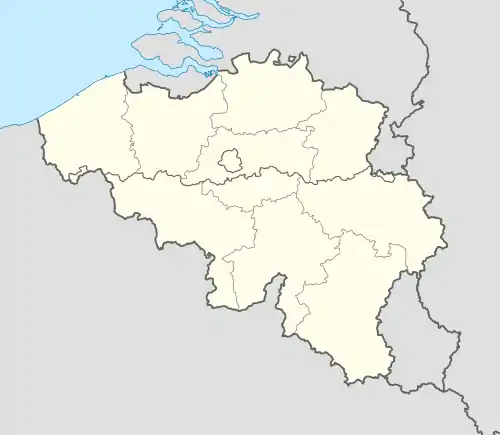 Étalle Location in Belgium
Location of Étalle in Luxembourg province 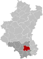 | |
| Coordinates: 49°41′N 05°36′E / 49.683°N 5.600°E | |
| Country | |
| Community | French Community |
| Region | Wallonia |
| Province | Luxembourg |
| Arrondissement | Virton |
| Government | |
| • Mayor | Henry Thiry (MR) |
| • Governing party/ies | Mayeur |
| Area | |
| • Total | 79.44 km2 (30.67 sq mi) |
| Population (2018-01-01)[1] | |
| • Total | 5,855 |
| • Density | 74/km2 (190/sq mi) |
| Postal codes | 6740-6743 |
| NIS code | 85009 |
| Area codes | 063 |
| Website | www |
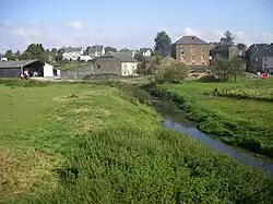
Étalle (French pronunciation: [etal]; Lorrain: Ètaule) is a municipality of Wallonia located in the province of Luxembourg, Belgium.
On 1 January 2007 the municipality, which covers 78.1 km2, had 5,389 inhabitants, giving a population density of 69 inhabitants per km2.
The municipality consists of the following districts: Buzenol, Chantemelle, Étalle, Sainte-Marie, Vance, and Villers-sur-Semois. Other population centers include: Croix Rouge, Fratin, Huombois, and Sivry.
See also
References
- ↑ "Wettelijke Bevolking per gemeente op 1 januari 2018". Statbel. Retrieved 9 March 2019.
External links
 Media related to Étalle, Belgium at Wikimedia Commons
Places adjacent to Étalle, Belgium | ||||||||||||||||
|---|---|---|---|---|---|---|---|---|---|---|---|---|---|---|---|---|
| ||||||||||||||||
Municipalities of the province of Luxembourg, Wallonia | ||
|---|---|---|
| Arlon | 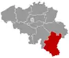 | |
| Bastogne | ||
| Marche-en-Famenne | ||
| Neufchâteau | ||
| Virton | ||
Bold indicates cities | ||
This article is issued from Wikipedia. The text is licensed under Creative Commons - Attribution - Sharealike. Additional terms may apply for the media files.