Čaková | |
|---|---|
 A street in Čaková | |
 Flag  Coat of arms | |
 Čaková Location in the Czech Republic | |
| Coordinates: 50°3′0″N 17°32′54″E / 50.05000°N 17.54833°E | |
| Country | |
| Region | Moravian-Silesian |
| District | Bruntál |
| First mentioned | 1498 |
| Area | |
| • Total | 11.93 km2 (4.61 sq mi) |
| Elevation | 515 m (1,690 ft) |
| Population (2023-01-01)[1] | |
| • Total | 324 |
| • Density | 27/km2 (70/sq mi) |
| Time zone | UTC+1 (CET) |
| • Summer (DST) | UTC+2 (CEST) |
| Postal code | 793 16 |
| Website | www |
Čaková (German: Friedersdorf) is a municipality and village in Bruntál District in the Moravian-Silesian Region of the Czech Republic. It has about 300 inhabitants.
Gallery
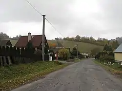
 Main road
 Entrance to Čaková
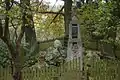 World War II memorial
References
Wikimedia Commons has media related to Čaková.
This article is issued from Wikipedia. The text is licensed under Creative Commons - Attribution - Sharealike. Additional terms may apply for the media files.