Al Mearad
المعراض | |
|---|---|
District | |
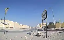 Al Hawsh Street in Al Mearad | |
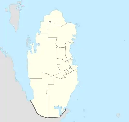  Al Mearad | |
| Coordinates: 25°15′00″N 51°22′24″E / 25.2500°N 51.3732°E | |
| Country |  Qatar Qatar |
| Municipality | Al Rayyan |
| Zone | Zone 55 |
| District no. | 90 |
| Area | |
| • Total | 19.8 km2 (7.6 sq mi) |
| Elevation | 40 m (130 ft) |
Al Mearad (Arabic: المعراض, romanized: Al Mi‘rāḑ) is a district in Qatar, located in the municipality of Al Rayyan.[3][4]
In the 2015 census, it was listed as a district of zone no. 55 which has a population of 283,675 and also includes New Fereej Al Ghanim, Al Aziziya, Al Waab, Fereej Al Soudan, Muaither, Bu Sidra, Fereej Al Manaseer, Fereej Al Murra and Al Sailiya.[3]
Al Sailiya is located to the immediate north of the district while the Doha Industrial Area is south.[4]
Etymology
The term "mearad" in Arabic means "obstruction". This name came about due to the fact that the district lies in the pathway of a nearby rawda (depression).[4]
Infrastructure
Ashghal (The Public Works Authority) launched a QR 6.6 million project to construct a religious complex in Al Mearad in November 2013. Maha Al Khaleej for Contracting Co. was selected as the contractor. As part of the project, a 1300 worshipper capacity mosque, an imam's house and a Quran learning center were constructed.[5]
Education

The following schools are located in Al Mearad:
| Name of School | Curriculum | Grade | Genders | Ref |
|---|---|---|---|---|
| Hind Bint Abu Sufyan Secondary School for Girls | Independent | Secondary | Female-only | [6] |
| Fatima Bint Al Walid Prep School for Girls | Independent | Secondary | Female-only | [7] |
| Al Taawun Primary School for Girls | Independent | Primary | Female-only | [7] |
| Al Huda Primary School for Girls | Independent | Primary | Female-only | [7] |
| Rawda bint Jassim Secondary School for Girls | Independent | Secondary | Female-only | [7] |
| Hajar Primary Independent School for Girls | Independent | Primary | Female-only | [8] |
| Hajar Independent Kindergarten for Girls | Independent | Kindergarten | Female-only | [9] |
References
- ↑ "District Area Map". Ministry of Development Planning and Statistics. Retrieved 12 February 2019.
- ↑ "Al Mearad, Zone 55, Qatar on the Elevation Map". elevationmap.net. Archived from the original on 16 May 2021. Retrieved 2 January 2019.
- 1 2 "2015 population census" (PDF). Ministry of Development Planning and Statistics. Archived from the original (PDF) on 14 February 2017. Retrieved 29 December 2018.
- 1 2 3 "District map". The Centre for Geographic Information Systems of Qatar. Archived from the original on 24 November 2020. Retrieved 30 December 2018.
- ↑ "Construction of Mosques, Quran teaching centres & imam houses (Package B) Al Mearad". Ashghal. Retrieved 1 January 2019.
- ↑ "Three govt schools to open this year". The Peninsula. 28 August 2018. Retrieved 1 January 2019.
- 1 2 3 4 "Ashghal completes construction of 13 new schools". The Peninsula. 10 September 2017. Retrieved 1 January 2019.
- ↑ "Hajar Primary Independent School For Girls". Ashghal. Retrieved 1 January 2019.
- ↑ "SEC Opens New KGs, Relocates and Closes Number of Independent Schools". Ministry of Education and Higher Education Qatar. 14 June 2014. Retrieved 1 January 2019.
Capital: Al Rayyan City | |
| Zone 51 | |
| Zone 52 | |
| Zone 53 | |
| Zone 54 | |
| Zone 55 |
|
| Zone 56 |
|
| Zone 81 | |
| Zone 83 |
|
| Zone 96 |
|
| Zone 97 | |
 Category:Al Rayyan Category:Al Rayyan | |