Albany, Oklahoma | |
|---|---|
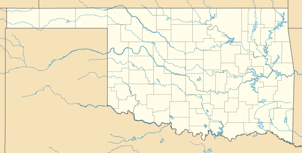 Albany, Oklahoma Location within Oklahoma  Albany, Oklahoma Location within the United States | |
| Coordinates: 33°52′37″N 96°09′36″W / 33.87694°N 96.16000°W | |
| Country | United States |
| State | Oklahoma |
| County | Bryan |
| Area | |
| • Total | 4.16 sq mi (10.76 km2) |
| • Land | 4.11 sq mi (10.63 km2) |
| • Water | 0.05 sq mi (0.13 km2) |
| Elevation | 581 ft (177 m) |
| Population (2020) | |
| • Total | 118 |
| • Density | 28.74/sq mi (11.10/km2) |
| Time zone | UTC-6 (Central (CST)) |
| • Summer (DST) | UTC-5 (Central Daylight (CDT)) |
| ZIP code | 74721 |
| Area code | 580 |
| FIPS code | 40-00950 |
| GNIS feature ID | 2629903[2] |
Albany is a census-designated place (CDP) and unincorporated community located in Bryan County, Oklahoma, United States, on State Highway 70E. The post office opened July 10, 1894.[3] The community was named for Albany, New York.[3] The population is 118 from the 2020 census, a decrease from 143 in 2010.[4] The area code is 580.
Demographics
| Census | Pop. | Note | %± |
|---|---|---|---|
| 2020 | 118 | — | |
| U.S. Decennial Census[5] | |||
References
- ↑ "ArcGIS REST Services Directory". United States Census Bureau. Retrieved September 20, 2022.
- 1 2 U.S. Geological Survey Geographic Names Information System: Albany, Oklahoma
- 1 2 Shirk, George H. Oklahoma Place Names. Norman: University of Oklahoma Press, 1987. ISBN 0-8061-2028-2
- ↑ "2010 City Population and Housing Occupancy Status". U.S. Census Bureau. Retrieved October 18, 2013.
- ↑ "Census of Population and Housing". Census.gov. Retrieved June 4, 2016.
Municipalities and communities of Bryan County, Oklahoma, United States | ||
|---|---|---|
| City | 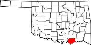 Bryan County map | |
| Towns | ||
| CDPs | ||
| Other communities | ||
| Ghost towns | ||
| Indian reservations | ||
| Footnotes | ‡This populated place also has portions in an adjacent county or counties | |
This article is issued from Wikipedia. The text is licensed under Creative Commons - Attribution - Sharealike. Additional terms may apply for the media files.