Allen | |
|---|---|
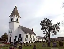 Asbury United Methodist Church and Cemetery | |
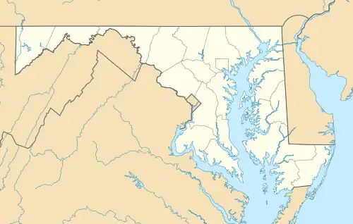 Allen Location within the state of Maryland  Allen Allen (the United States) | |
| Coordinates: 38°17′14″N 75°41′17″W / 38.28722°N 75.68806°W | |
| Country | United States |
| State | Maryland |
| County | Wicomico |
| Area | |
| • Total | 0.44 sq mi (1.14 km2) |
| • Land | 0.43 sq mi (1.12 km2) |
| • Water | 0.01 sq mi (0.01 km2) |
| Elevation | 10 ft (3 m) |
| Population (2020) | |
| • Total | 199 |
| • Density | 459.58/sq mi (177.25/km2) |
| Time zone | UTC−5 (Eastern (EST)) |
| • Summer (DST) | UTC−4 (EDT) |
| ZIP code | 21810 |
| Area codes | 410 & 443 |
| FIPS code | 24-00800 |
| GNIS feature ID | 589634[2] |
Allen is an unincorporated community and census-designated place in Wicomico County, Maryland, United States.[2] Its population was 210 as of the 2010 census.[3] It is part of the Salisbury, Maryland-Delaware Metropolitan Statistical Area.
The Asbury Methodist Episcopal Church, Bennett's Adventure, and Bounds Lott are listed on the National Register of Historic Places.[4]
Demographics
| Census | Pop. | Note | %± |
|---|---|---|---|
| 2020 | 199 | — | |
| U.S. Decennial Census[5] | |||
References
- ↑ "2020 U.S. Gazetteer Files". United States Census Bureau. Retrieved April 26, 2022.
- 1 2 "Allen". Geographic Names Information System. United States Geological Survey, United States Department of the Interior.
- ↑ "U.S. Census website". United States Census Bureau. Retrieved May 14, 2011.
- ↑ "National Register Information System". National Register of Historic Places. National Park Service. July 9, 2010.
- ↑ "Census of Population and Housing". Census.gov. Retrieved June 4, 2016.
Municipalities and communities of Wicomico County, Maryland, United States | ||
|---|---|---|
| Cities | 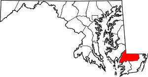 | |
| Towns | ||
| CDPs | ||
| Unincorporated communities | ||
| Footnotes | ‡This populated place also has portions in an adjacent county or counties | |
This article is issued from Wikipedia. The text is licensed under Creative Commons - Attribution - Sharealike. Additional terms may apply for the media files.