Amtali
আমতলী | |
|---|---|
.svg.png.webp) | |
| Coordinates: 22°7.764′N 90°13.734′E / 22.129400°N 90.228900°E | |
| Country | |
| Division | Barisal Division |
| District | Barguna District |
| Area | |
| • Total | 386.92 km2 (149.39 sq mi) |
| Population (2011) | |
| • Total | 182,798 |
| • Density | 470/km2 (1,200/sq mi) |
| Time zone | UTC+6 (BST) |
| Website | Official Map of the Amtali Upazila |
Amtali (Bengali: আমতলী) is an upazila of Barguna District[1] in the division of Barisal, Bangladesh.Its a coastal area.
Geography
Amtali is at 22°07′46″N 90°13′44″E / 22.1294°N 90.2289°E. It has 45,804 households and a total area of 695 square km with 212 square km of water bodies.
Demographics
| Year | Pop. (000) | ±% |
|---|---|---|
| 1981 | 232 | — |
| 1991 | 244 | +5.2% |
| 2001 | 260 | +6.6% |
| 2011 | 271 | +4.2% |
| Source: Bangladesh Bureau of Statistics[2] | ||
As of the 2011 Bangladesh census, Amtali has a population of 182,798 living in 42,201 households. Amtali has an average literacy rate of 51.73% (7+ years) and a sex ratio of 1066 females per 1000 males. 21,808 (11.93%) of the population lived in urban areas.[3]
Administration
Amtali Upazila is divided into Amtali Municipality and seven union parishads: Amtali, Arpangasia, Atharogasia,Chawra, Gulishakhali, Holodia, and Kukua.[2][4]
Amtali Municipality is subdivided into 9 wards and 14 mahallas.[2]
See also
References
- ↑ Shabuddin Panna (2012). "Amtali Upazila". In Sirajul Islam and Ahmed A. Jamal (ed.). Banglapedia: National Encyclopedia of Bangladesh (Second ed.). Asiatic Society of Bangladesh.
- 1 2 3 "District Statistics 2011: Barguna" (PDF). Bangladesh Bureau of Statistics. Archived from the original (PDF) on 13 November 2014. Retrieved 14 July 2014.
- 1 2 "Population Census 2011 Community Tables: Barguna" (PDF). Bangladesh Bureau of Statistics.
- ↑ "List of Unions". Taltali Upazila. Archived from the original on 2020-11-28. Retrieved 2020-11-20.
External links
Capital: Barguna | ||
| Upazilas | ||
| Constituencies | ||
| Attractions and sites | ||
| History | ||
| Inhabited areas |
| |
| Educational institutions | ||
| Rivers and transport |
| |
Capital: Barisal | ||
| Barguna District | 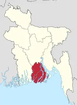 | |
| Barisal District | ||
| Bhola District | ||
| Jhalokati District | ||
| Patuakhali District | ||
| Pirojpur District | ||