Arapahoe, Colorado | |
|---|---|
 Arapahoe Location of the Arapahoe CDP in the State of Colorado. | |
| Coordinates: 38°51′11″N 102°10′44″W / 38.8529187°N 102.1788968°W[1] | |
| Country | |
| State | |
| County | Cheyenne County |
| Established | 1870[2] |
| Government | |
| • Type | unincorporated town |
| Area | |
| • Total | 0.277 sq mi (0.718 km2) |
| • Land | 0.277 sq mi (0.718 km2) |
| • Water | 0.000 sq mi (0.000 km2) |
| Elevation | 4,026 ft (1,227 m) |
| Population | |
| • Total | 102 |
| • Density | 370/sq mi (140/km2) |
| Time zone | UTC-7 (MST) |
| • Summer (DST) | UTC-6 (MDT) |
| ZIP Code[5] | 80802 |
| Area code | 719 |
| GNIS feature[3] | Arapahoe CDP |
Arapahoe is an unincorporated town, a post office, and a census-designated place (CDP) located in and governed by Cheyenne County, Colorado, United States. The population was 102 at the 2020 census.[4] The Arapahoe post office has the ZIP code 80802.[5]
History
The first town of Arapahoe was established in 1859 in Arapahoe County, Kansas Territory (present-day Jefferson County, Colorado; see Arapahoe, Colorado (ghost town).)[2] The town withered in a few years.
A new town of Arapahoe was established at the present site in 1870.[2] The second Arapahoe post office opened on May 5, 1910.[6]
The name honors the Arapaho Native American people who lived in the area.
Geography
The Arapahoe CDP has an area of 177 acres (0.718 km2), all land.[1]
Demographics
The United States Census Bureau defined the Arapahoe CDP for the United States Census 2020.
| Year | Pop. | ±% |
|---|---|---|
| 2020 | 102 | — |
| Source: United States Census Bureau | ||
See also
References
- 1 2 3 "State of Colorado Census Designated Places - BAS20 - Data as of January 1, 2020". United States Census Bureau. Retrieved December 2, 2020.
- 1 2 3 Eichler, Geo. R. (1977). Colorado Place Names. Johnson Publishing Company.
- 1 2 3 "U.S. Board on Geographic Names: Domestic Names". United States Geological Survey. Retrieved December 2, 2020.
- 1 2 United States Census Bureau. "Arapahoe CDP, Colorado". Retrieved April 5, 2023.
- 1 2 "Look Up a ZIP Code". United States Postal Service. Retrieved December 2, 2020.
- ↑ Bauer, William H.; James L. Ozment; John H. Willard (1990). Colorado Post Offices 1859-1989. The Colorado Railroad Museum. ISBN 0-918654-42-4.
External links
Municipalities and communities of Cheyenne County, Colorado, United States | ||
|---|---|---|
| Towns | 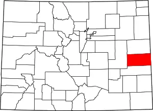 Map of Colorado highlighting Cheyenne County | |
| CDP | ||
| Other unincorporated communities | ||