Argenton-les-Vallées | |
|---|---|
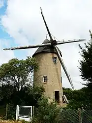 The windmill in Argenton-les-Vallées | |
.svg.png.webp) Coat of arms | |
Location of Argenton-les-Vallées | |
 Argenton-les-Vallées  Argenton-les-Vallées | |
| Coordinates: 46°59′08″N 0°26′54″W / 46.9856°N 0.4483°W | |
| Country | France |
| Region | Nouvelle-Aquitaine |
| Department | Deux-Sèvres |
| Arrondissement | Bressuire |
| Canton | Argenton-les-Vallées |
| Commune | Argentonnay |
| Area 1 | 28.42 km2 (10.97 sq mi) |
| Population (2019)[1] | 1,575 |
| • Density | 55/km2 (140/sq mi) |
| Time zone | UTC+01:00 (CET) |
| • Summer (DST) | UTC+02:00 (CEST) |
| Postal code | 79150 |
| Elevation | 70–139 m (230–456 ft) |
| 1 French Land Register data, which excludes lakes, ponds, glaciers > 1 km2 (0.386 sq mi or 247 acres) and river estuaries. | |
Argenton-les-Vallées (French pronunciation: [aʁʒɑ̃tɔ̃ le vale]) is a former commune in the Deux-Sèvres department in western France. On 1 January 2016, it was merged into the new commune Argentonnay, and became a delegated commune of Argentonnay.[2] It is situated in the valley of the River Argenton, from which it takes its name.
It was created on 1 September 2006 from the amalgamation of the communes of Argenton-Château, Boësse and Sanzay.[3][4]
See also
References
- ↑ Téléchargement du fichier d'ensemble des populations légales en 2019, INSEE
- ↑ Arrêté préfectoral 17 November 2015 (in French)
- ↑ (in French) Arrêté du 8 juin 2006 relatif à une fusion de communes (correction)
- ↑ (in French) Argenton-les-Vallées on INSEE website
External links
 Media related to Argenton-les-Vallées at Wikimedia Commons
This article is issued from Wikipedia. The text is licensed under Creative Commons - Attribution - Sharealike. Additional terms may apply for the media files.