Ariranha | |
|---|---|
 Flag  Coat of arms | |
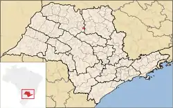 Location in São Paulo state | |
 Ariranha Location in Brazil | |
| Coordinates: 21°11′16″S 48°47′13″W / 21.18778°S 48.78694°W | |
| Country | Brazil |
| Region | Southeast |
| State | São Paulo |
| Mesoregion | São José do Rio Preto |
| Microregion | Catanduva |
| Area | |
| • Total | 132.6 km2 (51.2 sq mi) |
| Elevation | 595 m (1,952 ft) |
| Population (2020 [1]) | |
| • Total | 9,761 |
| • Density | 74/km2 (190/sq mi) |
| Time zone | UTC−3 (BRT) |
| Postal code | 15960-000 |
| Area code | +55 17 |
| Website | www |
Ariranha is a municipality in the state of São Paulo, Brazil. The population is 9,761 (2020 est.) in an area of 132.6 km².[2] Ariranha belongs to the Mesoregion of São José do Rio Preto.
References
This article is issued from Wikipedia. The text is licensed under Creative Commons - Attribution - Sharealike. Additional terms may apply for the media files.