| Bandiana Victoria | |
|---|---|
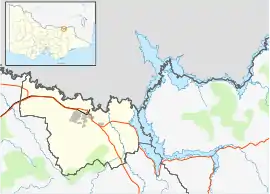 Bandiana | |
| Coordinates | 36°09′S 146°55′E / 36.150°S 146.917°E |
| Population | 615 (2016 census)[1] |
| Postcode(s) | 3694 |
| LGA(s) | City of Wodonga |
| Region | Northeast Victoria |
| State electorate(s) | Benambra |
| Federal division(s) | Indi |
Bandiana is a Suburb of the City of Wodonga local government area in northeast Victoria, Australia.
History
Bandiana takes its name from the early name for the area, probably from a First Nations toponym.
The hill now known as Bears Hill appears as Bandiana Range in early maps[2] and the Street family selected the property Bandiana Park in the late 1800s.[3]
The Australian Defence Force has had a logistics and maintenance base in the area since 1942 and there was once a rail line and station servicing the area. Bandiana Military Post Office opened on 28 September 1942 and the region is still a major Australian Army logistics facility.[4][5]
Population
In the 2016 Census, there were 615 people in Bandiana. 86.4% of people were born in Australia and 89.6% of people only spoke English at home. The most common responses for religion were Catholic 22.5%. Of the employed people in Bandiana, 56.8% worked in Defence.[1]
Today
The Bandiana Army Golf Club on Donegan Road is now closed.
See also
References
- 1 2 Australian Bureau of Statistics (27 June 2017). "Bandiana (State Suburb)". 2016 Census QuickStats. Retrieved 3 March 2018.
- ↑ "Suburban & country lands, Parish of Belvoir, Murray River". Victoria. Department of Crown Lands and Survey. 1859. Retrieved 21 September 2019.
- ↑ "Melbourne Markets". The Argus, Melbourne. 20 August 1885. Retrieved 21 September 2019.
- ↑ "Bandiana Military Area" (PDF). Defence.gov.
- ↑ Premier Postal History, Post Office List, retrieved 11 April 2008
Localities in the City of Wodonga | ||
|---|---|---|
| City |
| |
| Town |
| |
| Locality |
| |
^ - Territory divided with another LGA | ||