Bascom, Ohio | |
|---|---|
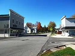 Running concurrently with Ohio State Route 18, Tiffin Street bisects Bascom. | |
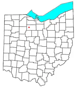 Location of Bascom | |
| Coordinates: 41°07′58″N 83°17′07″W / 41.13278°N 83.28528°W | |
| Country | United States |
| State | Ohio |
| County | Seneca |
| Area | |
| • Total | 1.51 sq mi (3.92 km2) |
| • Land | 1.51 sq mi (3.92 km2) |
| • Water | 0.00 sq mi (0.00 km2) |
| Elevation | 774 ft (236 m) |
| Population (2020) | |
| • Total | 397 |
| • Density | 262.22/sq mi (101.21/km2) |
| Time zone | UTC-5 (Eastern (EST)) |
| • Summer (DST) | UTC-4 (EDT) |
| ZIP code | 44809 |
| Area code | 419 |
| GNIS feature ID | 1048488[2] |
Bascom (/ˈbæskəm/ BAS-kəm[3]) is a census-designated place in western Hopewell Township, Seneca County, Ohio.[4] It has a post office with the ZIP code 44809 and hosts Hopewell-Loudon High School.[5] The community is located at the intersection of State Routes 18 and 635 east of Fostoria. The population was 397 at the 2020 census.
Demographics
| Census | Pop. | Note | %± |
|---|---|---|---|
| 2020 | 397 | — | |
| U.S. Decennial Census[6] | |||
History
Bascom was laid out in 1837.[7] The community derives its name from Scott & Bascom, publishers of The Ohio State Journal.[8][9] A post office called Bascom has been in operation since 1850.[10]
References
- ↑ "ArcGIS REST Services Directory". United States Census Bureau. Retrieved September 20, 2022.
- 1 2 "US Board on Geographic Names". United States Geological Survey. October 25, 2007. Retrieved January 31, 2008.
- ↑ "E.W. Scripps School of Journalism Ohio Pronunciation Guide | Ohio University". www.ohio.edu. Ohio University. 2016. Retrieved October 22, 2022.
- ↑ U.S. Geological Survey Geographic Names Information System: Bascom, Ohio
- ↑ USPS – Cities by ZIP Code Archived June 15, 2011, at the Wayback Machine
- ↑ "Census of Population and Housing". Census.gov. Retrieved June 4, 2016.
- ↑ Lang, William (1880). History of Seneca County, from the Close of the Revolutionary War to July, 1880. Transcript Printing Company. pp. 540.
- ↑ AC10235922, Anonymus (1853). Register of Officers and Agents, Civil, Military, and Naval, in the Service of the United States. Armstrong.
{{cite book}}: CS1 maint: numeric names: authors list (link) - ↑ Baughman, Abraham J. (1911). History of Seneca County, Ohio: A Narrative Account of Its Historical Progress, Its People, and Its Principal Interests. Lewis Publishing Company. p. 437.
- ↑ "Seneca County". Jim Forte Postal History. Archived from the original on January 5, 2016. Retrieved December 27, 2015.
External links
Municipalities and communities of Seneca County, Ohio, United States | ||
|---|---|---|
| Cities | 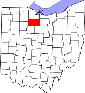 Map of Ohio highlighting Seneca County | |
| Villages | ||
| Townships | ||
| CDPs | ||
| Unincorporated communities | ||
| Ghost towns | ||
| Footnotes | ‡This populated place also has portions in an adjacent county or counties | |
41°07′58″N 83°17′07″W / 41.13278°N 83.28528°W
This article is issued from Wikipedia. The text is licensed under Creative Commons - Attribution - Sharealike. Additional terms may apply for the media files.