Beaucoudray | |
|---|---|
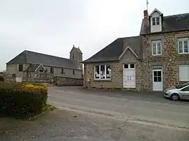 The town hall and the church of Saint-Laurent | |
Location of Beaucoudray | |
 Beaucoudray  Beaucoudray | |
| Coordinates: 48°57′33″N 1°08′27″W / 48.9592°N 1.1408°W | |
| Country | France |
| Region | Normandy |
| Department | Manche |
| Arrondissement | Saint-Lô |
| Canton | Condé-sur-Vire |
| Intercommunality | Saint-Lô Agglo |
| Government | |
| • Mayor (2020–2026) | Michel de Beaucoudrey[1] |
| Area 1 | 4.70 km2 (1.81 sq mi) |
| Population | 133 |
| • Density | 28/km2 (73/sq mi) |
| Time zone | UTC+01:00 (CET) |
| • Summer (DST) | UTC+02:00 (CEST) |
| INSEE/Postal code | 50039 /50420 |
| Elevation | 84–204 m (276–669 ft) (avg. 170 m or 560 ft) |
| 1 French Land Register data, which excludes lakes, ponds, glaciers > 1 km2 (0.386 sq mi or 247 acres) and river estuaries. | |
Beaucoudray (French pronunciation: [bokudʁɛ]) is a commune in the Manche department in the Normandy region in northwestern France.
Population
| Year | Pop. | ±% p.a. |
|---|---|---|
| 1968 | 188 | — |
| 1975 | 169 | −1.51% |
| 1982 | 131 | −3.57% |
| 1990 | 119 | −1.19% |
| 1999 | 129 | +0.90% |
| 2009 | 153 | +1.72% |
| 2014 | 146 | −0.93% |
| 2020 | 129 | −2.04% |
| Source: INSEE[3] | ||
See also
References
- ↑ "Répertoire national des élus: les maires". data.gouv.fr, Plateforme ouverte des données publiques françaises (in French). 2 December 2020.
- ↑ "Populations légales 2021". The National Institute of Statistics and Economic Studies. 28 December 2023.
- ↑ Population en historique depuis 1968, INSEE
Wikimedia Commons has media related to Beaucoudray.
This article is issued from Wikipedia. The text is licensed under Creative Commons - Attribution - Sharealike. Additional terms may apply for the media files.