| Ben Tirran | |
|---|---|
 Ben Tirran | |
| Highest point | |
| Elevation | 896 m (2,940 ft)[1] |
| Prominence | 244 m (801 ft) |
| Listing | Corbett, Marilyn |
| Coordinates | 56°51′31″N 3°01′45″W / 56.8586°N 3.0291°W |
| Geography | |
| Location | Angus, Scotland |
| Parent range | Grampian Mountains |
| OS grid | NO373746 |
| Topo map | OS Landranger 44 |
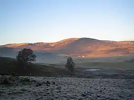
Ben Tirran (896 m) is a mountain in the Grampian Mountains of Scotland. It lies in the vast Mounth area of the eastern Highlands in Angus, on the northern side of Glen Clova.
A rounded peak, Ben Tirran is the highest point of a wide plateau. A number of lochans lie below its summit. The nearest town is Kirriemuir to the south.[2]
References
- ↑ "Ben Tirran". hill-bagging.co.uk. Retrieved 31 May 2019.
- ↑ "walkhighlands Ben Tirran". walkhighlands.co.uk. Retrieved 31 May 2019.
This article is issued from Wikipedia. The text is licensed under Creative Commons - Attribution - Sharealike. Additional terms may apply for the media files.