Bennezette Township, Butler County | |
|---|---|
 | |
| Coordinates: 42°51′46″N 092°57′52″W / 42.86278°N 92.96444°W | |
| Country | |
| State | |
| County | Butler |
| Area | |
| • Total | 36.87 sq mi (95.5 km2) |
| • Land | 36.87 sq mi (95.5 km2) |
| • Water | 0 sq mi (0 km2) |
| Elevation | 1,050 ft (320 m) |
| Population (2020) | |
| • Total | 224 |
| • Density | 6.1/sq mi (2.3/km2) |
| FIPS code | 19-90195[2] |
| GNIS feature ID | 0467438 |
Bennezette Township is one of sixteen townships in Butler County, Iowa, USA. As of the 2020 census, its population was 224.[3]
Geography
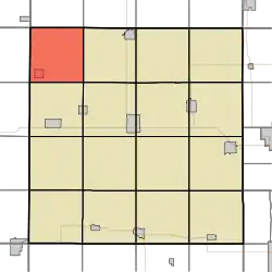
Bennezette Township covers an area of 36.87 square miles (95.5 km2) and contains one incorporated settlement, Aredale.
References
- ↑ "US Board on Geographic Names". United States Geological Survey. October 25, 2007. Retrieved January 31, 2008.
- ↑ "U.S. Census website". United States Census Bureau. Retrieved January 31, 2008.
- ↑ "U.S. Census website". United States Census Bureau. Retrieved July 19, 2020.
External links
Municipalities and communities of Butler County, Iowa, United States | ||
|---|---|---|
| Cities | Map of Iowa highlighting Butler County | |
| Townships | ||
| Unincorporated communities | ||
| Footnotes | ‡This populated place also has portions in an adjacent county or counties | |
This article is issued from Wikipedia. The text is licensed under Creative Commons - Attribution - Sharealike. Additional terms may apply for the media files.