| Berryfields | |
|---|---|
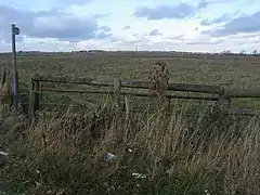 Footpath to Hardwick by Berryfield House | |
 Berryfields Location within Buckinghamshire | |
| Population | 5,000 |
| OS grid reference | SP7816 |
| Civil parish |
|
| Unitary authority | |
| Ceremonial county | |
| Region | |
| Country | England |
| Sovereign state | United Kingdom |
| Post town | AYLESBURY |
| Postcode district | HP18 |
| Dialling code | 01296 |
| Police | Thames Valley |
| Fire | Buckinghamshire |
| Ambulance | South Central |
| UK Parliament | |
Berryfields is a Major Development Area (MDA) to the north-west of Aylesbury, Buckinghamshire, England.[1] It is one of two new major housing projects in Aylesbury, the other being Weedon Hill, adjacent and to the east.[2] It is intended that these two areas will provide 5,000 new homes between them by 2021.[3]
The housing development being built at Weedon Hill has formed its own civil parish of Buckingham Park and Berryfields has been a civil parish since 2015.
Transport
A new railway station, Aylesbury Vale Parkway opened on 14 December 2008, ready to serve the new housing.[4] The Western Link Road, connecting the A41 and the A418, was originally scheduled to open in March 2009; it eventually opened in 2014.
A Redline bus service connects Berryfields to Aylesbury town centre.
References
- ↑ "Berryfields Development Brief" (PDF). Retrieved 15 June 2017.
- ↑ "Berryfields". Archived from the original on 4 September 2011.
- ↑ "The Town Today". Aylesbury Town Council. Retrieved 3 August 2010.
- ↑ "Services at Aylesbury's new train station to begin on Sunday". Archived from the original on 2 August 2012.