Blucksberg Mountain, South Dakota | |
|---|---|
 Blucksberg Mountain, South Dakota  Blucksberg Mountain, South Dakota | |
| Coordinates: 44°21′34″N 103°27′14″W / 44.35944°N 103.45389°W | |
| Country | United States |
| State | South Dakota |
| County | Meade |
| Area | |
| • Total | 0.67 sq mi (1.73 km2) |
| • Land | 0.67 sq mi (1.73 km2) |
| • Water | 0.00 sq mi (0.00 km2) |
| Elevation | 3,885 ft (1,184 m) |
| Population | |
| • Total | 467 |
| • Density | 698.06/sq mi (269.70/km2) |
| Time zone | UTC-7 (Mountain (MST)) |
| • Summer (DST) | UTC-6 (MDT) |
| Area code | 605 |
| GNIS feature ID | 2584547[2] |
Blucksberg Mountain is an unincorporated community and census-designated place in Meade County, South Dakota, United States. Its population was 467 as of the 2020 census.[4] Interstate 90 passes through the community.
Geography
According to the U.S. Census Bureau, the community has an area of 0.668 square miles (1.73 km2), all land.[5]
Demographics
| Census | Pop. | Note | %± |
|---|---|---|---|
| 2020 | 467 | — | |
| U.S. Decennial Census[6] | |||
References
- ↑ "ArcGIS REST Services Directory". United States Census Bureau. Retrieved October 15, 2022.
- 1 2 U.S. Geological Survey Geographic Names Information System: Blucksberg Mountain, South Dakota
- ↑ "Census Population API". United States Census Bureau. Retrieved October 15, 2022.
- ↑ "U.S. Census Bureau: Blucksberg Mountain CDP, South Dakota". www.census.gov. United States Census Bureau. Retrieved February 26, 2022.
- ↑ "2010 Census Gazetteer Files - Places: South Dakota". U.S. Census Bureau. Retrieved January 28, 2017.
- ↑ "Census of Population and Housing". Census.gov. Retrieved June 4, 2016.
Municipalities and communities of Meade County, South Dakota, United States | ||
|---|---|---|
| Cities | 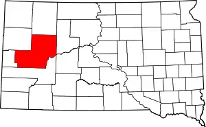 Meade County map | |
| CDPs | ||
| Former CDP | ||
| Other communities | ||
| Indian reservations | ||
| Ghost towns | ||
| Footnotes | ‡This populated place also has portions in an adjacent county or counties | |
This article is issued from Wikipedia. The text is licensed under Creative Commons - Attribution - Sharealike. Additional terms may apply for the media files.