Boleráz | |
|---|---|
Municipality | |
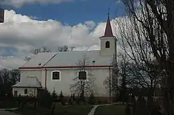 St. Michael's church, Boleráz | |
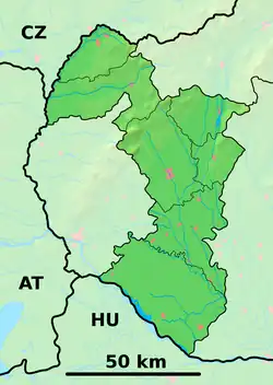 Boleráz Location of Boleráz in the Trnava Region 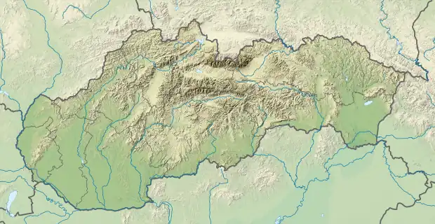 Boleráz Boleráz (Slovakia) | |
| Coordinates: 48°28′N 17°30′E / 48.467°N 17.500°E | |
| Country | Slovakia |
| Region | Trnava |
| District | Trnava |
| Area | |
| • Total | 25.44[1] km2 (9.82[1] sq mi) |
| Elevation | 172[2] m (564[2] ft) |
| Population (2021) | |
| • Total | 2,349[3] |
| Postal code | 919 08[2] |
| Area code | +421 33[2] |
| Car plate | TT |
| Website | boleraz.eu |
Boleráz (Hungarian: Bélaház) is a municipality of Trnava District in the Trnava region of Slovakia.
Genealogical resources
The records for genealogical research are available at the state archive "Statny Archiv in Bratislava, Slovakia"
- Roman Catholic church records (births/marriages/deaths): 1669-1895 (parish A)
- Lutheran church records (births/marriages/deaths): 1666-1895 (parish B)
- Reformated church records (births/marriages/deaths): 1666-1895 (parish B)
See also
References
- 1 2 "Hustota obyvateľstva - obce [om7014rr_ukaz: Rozloha (Štvorcový meter)]". www.statistics.sk (in Slovak). Statistical Office of the Slovak Republic. 2022-03-31. Retrieved 2022-03-31.
- 1 2 3 4 "Základná charakteristika". www.statistics.sk (in Slovak). Statistical Office of the Slovak Republic. 2015-04-17. Retrieved 2022-03-31.
- ↑ "Počet obyvateľov podľa pohlavia - obce (ročne)". www.statistics.sk (in Slovak). Statistical Office of the Slovak Republic. 2022-03-31. Retrieved 2022-03-31.
External links
Wikimedia Commons has media related to Boleráz.
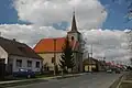 Church in Boleráz-Klčovany
This article is issued from Wikipedia. The text is licensed under Creative Commons - Attribution - Sharealike. Additional terms may apply for the media files.