Bromberg | |
|---|---|
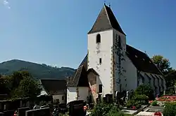 Bromberg parish church | |
 Coat of arms | |
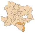
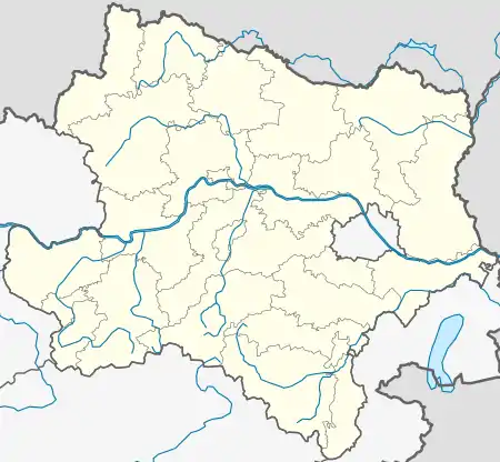 Bromberg Location within Austria  Bromberg Bromberg (Austria) | |
| Coordinates: 47°40′00″N 16°11′00″E / 47.66667°N 16.18333°E | |
| Country | Austria |
| State | Lower Austria |
| District | Wiener Neustadt-Land |
| Government | |
| • Mayor | Josef Schrammel (ÖVP) |
| Area | |
| • Total | 30.89 km2 (11.93 sq mi) |
| Elevation | 487 m (1,598 ft) |
| Population (2018-01-01)[2] | |
| • Total | 1,232 |
| • Density | 40/km2 (100/sq mi) |
| Time zone | UTC+1 (CET) |
| • Summer (DST) | UTC+2 (CEST) |
| Postal code | 2802, 2811, 2813, 2822, 2833 |
| Area code | 02629 |
| Vehicle registration | WB |
| Website | www.bromberg.at |
Bromberg is a town in the district of Wiener Neustadt-Land in the Austrian state of Lower Austria.
Population
| Year | Pop. | ±% |
|---|---|---|
| 1869 | 1,520 | — |
| 1880 | 1,708 | +12.4% |
| 1890 | 1,590 | −6.9% |
| 1900 | 1,546 | −2.8% |
| 1910 | 1,486 | −3.9% |
| 1923 | 1,528 | +2.8% |
| 1934 | 1,435 | −6.1% |
| 1939 | 1,291 | −10.0% |
| 1951 | 1,231 | −4.6% |
| 1961 | 1,065 | −13.5% |
| 1971 | 1,052 | −1.2% |
| 1981 | 1,162 | +10.5% |
| 1991 | 1,207 | +3.9% |
| 2001 | 1,193 | −1.2% |
| 2011 | 1,211 | +1.5% |
| 2015 | 1,232 | +1.7% |
References
- ↑ "Dauersiedlungsraum der Gemeinden Politischen Bezirke und Bundesländer - Gebietsstand 1.1.2018". Statistics Austria. Retrieved 10 March 2019.
- ↑ "Einwohnerzahl 1.1.2018 nach Gemeinden mit Status, Gebietsstand 1.1.2018". Statistics Austria. Retrieved 9 March 2019.
This article is issued from Wikipedia. The text is licensed under Creative Commons - Attribution - Sharealike. Additional terms may apply for the media files.