Browntown, South Carolina | |
|---|---|
 Browntown  Browntown | |
| Coordinates: 34°12′11″N 80°18′59″W / 34.20306°N 80.31639°W | |
| Country | United States |
| State | South Carolina |
| County | Lee |
| Area | |
| • Total | 2.46 sq mi (6.37 km2) |
| • Land | 2.46 sq mi (6.37 km2) |
| • Water | 0.00 sq mi (0.00 km2) |
| Elevation | 260 ft (80 m) |
| Population | |
| • Total | 206 |
| • Density | 83.81/sq mi (32.36/km2) |
| Time zone | UTC-5 (Eastern (EST)) |
| • Summer (DST) | UTC-4 (EDT) |
| ZIP Code | 29010 (Bishopville) |
| Area code(s) | 803/839 |
| FIPS code | 45-09782 |
| GNIS feature ID | 2807066[3] |
Browntown is an unincorporated community and census-designated place (CDP) in Lee County, South Carolina, United States. It was first listed as a CDP prior to the 2020 census.[3] The population as of 2020 was 206.[4]
The CDP is in northwestern Lee County, 4 miles (6 km) west of Bishopville, the county seat. Interstate 20 forms the southern edge of the CDP, with the closest access being from Exit 116 (U.S. Route 15), 3 miles (5 km) to the east. The southwest edge of the CDP is Scape Ore Swamp, a southeast-flowing tributary of the Black River and part of the Winyah Bay watershed.
Demographics
| Census | Pop. | Note | %± |
|---|---|---|---|
| 2020 | 206 | — | |
| U.S. Decennial Census[5] 2020[6][2] | |||
2020 census
| Race / Ethnicity | Pop 2020[6] | % 2020 |
|---|---|---|
| White alone (NH) | 22 | 10.68% |
| Black or African American alone (NH) | 174 | 84.47% |
| Native American or Alaska Native alone (NH) | 1 | 0.49% |
| Asian alone (NH) | 0 | 0.00% |
| Pacific Islander alone (NH) | 0 | 0.00% |
| Some Other Race alone (NH) | 0 | 0.00% |
| Mixed Race/Multi-Racial (NH) | 7 | 3.40% |
| Hispanic or Latino (any race) | 2 | 0.97% |
| Total | 206 | 100.00% |
References
- ↑ "ArcGIS REST Services Directory". United States Census Bureau. Retrieved October 15, 2022.
- 1 2 "Census Population API". United States Census Bureau. Retrieved October 15, 2022.
- 1 2 "Browntown Census Designated Place". Geographic Names Information System. United States Geological Survey, United States Department of the Interior.
- ↑ "Browntown CDP, South Carolina". United States Census Bureau. Retrieved April 7, 2022.
- ↑ "Decennial Census of Population and Housing by Decades". US Census Bureau.
- 1 2 "P2 HISPANIC OR LATINO, AND NOT HISPANIC OR LATINO BY RACE – 2020: DEC Redistricting Data (PL 94-171) – Browntown CDP, South Carolina". United States Census Bureau.
Municipalities and communities of Lee County, South Carolina, United States | ||
|---|---|---|
| City | 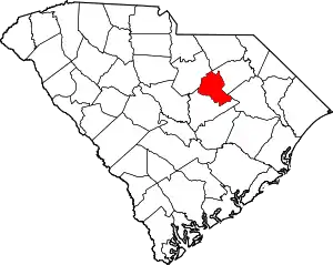 Map of South Carolina highlighting Lee County | |
| Town | ||
| CDPs | ||
| Other community | ||
| Footnotes | ‡This populated place also has portions in an adjacent county or counties | |
This article is issued from Wikipedia. The text is licensed under Creative Commons - Attribution - Sharealike. Additional terms may apply for the media files.